Ticket
From Interlaken: Ticket Jungfraujoch incl. seat reservation
4.7(123)All day
FromCHF 121.90
FromCHF 121.90

95 Activities
From Interlaken: Ticket Jungfraujoch incl. seat reservation
From Grindelwald: Ticket Jungfraujoch incl. seat reservation

Ticket Grindelwald First - Top of Adventure
Ticket funicular Harder Kulm from Interlaken Ost

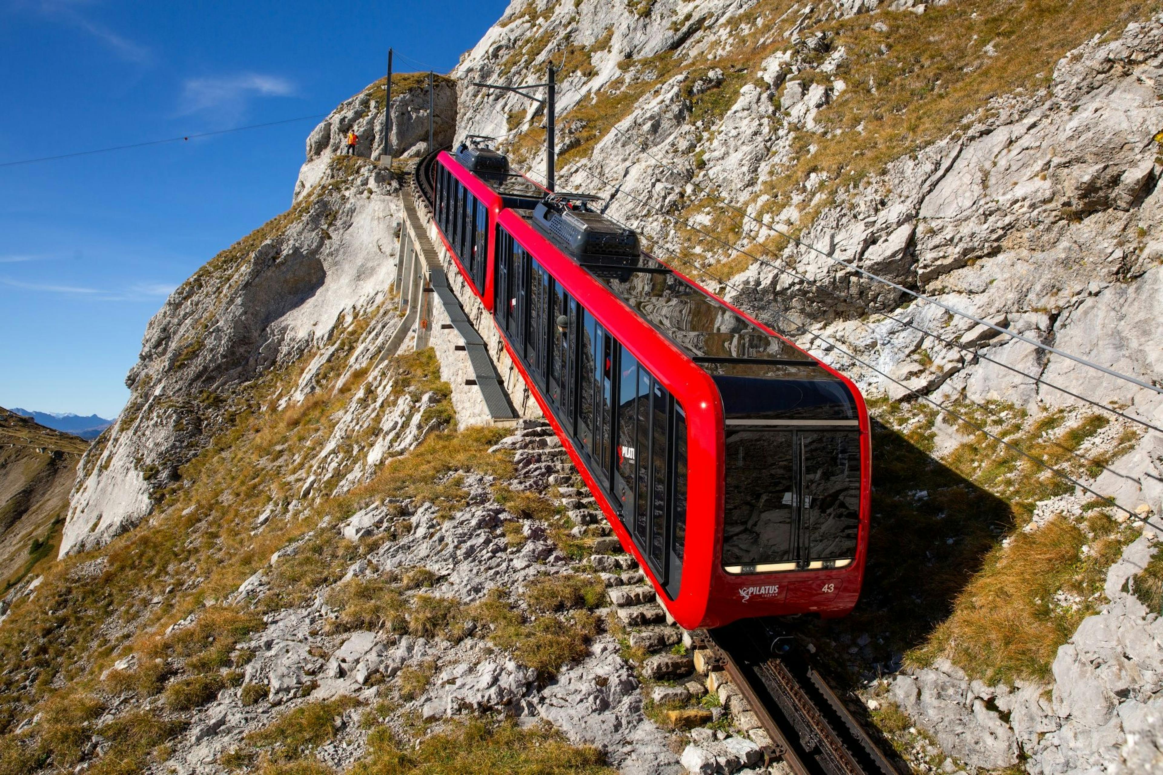
Mt. Pilatus self-guided trip by cogwheel train and cable car from/to Alpnachstad or Kriens

Mount Titlis or Trübsee ticket from Engelberg

From Lauterbrunnen: Ticket Jungfraujoch incl. seat reservation

Gornergrat Bahn ticket from Zermatt
Schilthorn Ticket from Mürren or Stechelberg

Ticket Glacier 3000 Les Diableretes from Col du Pillon
Schynige Platte Ticket rack railroad from Wilderswil

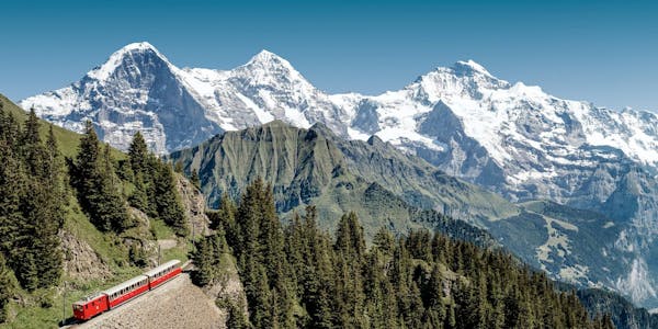
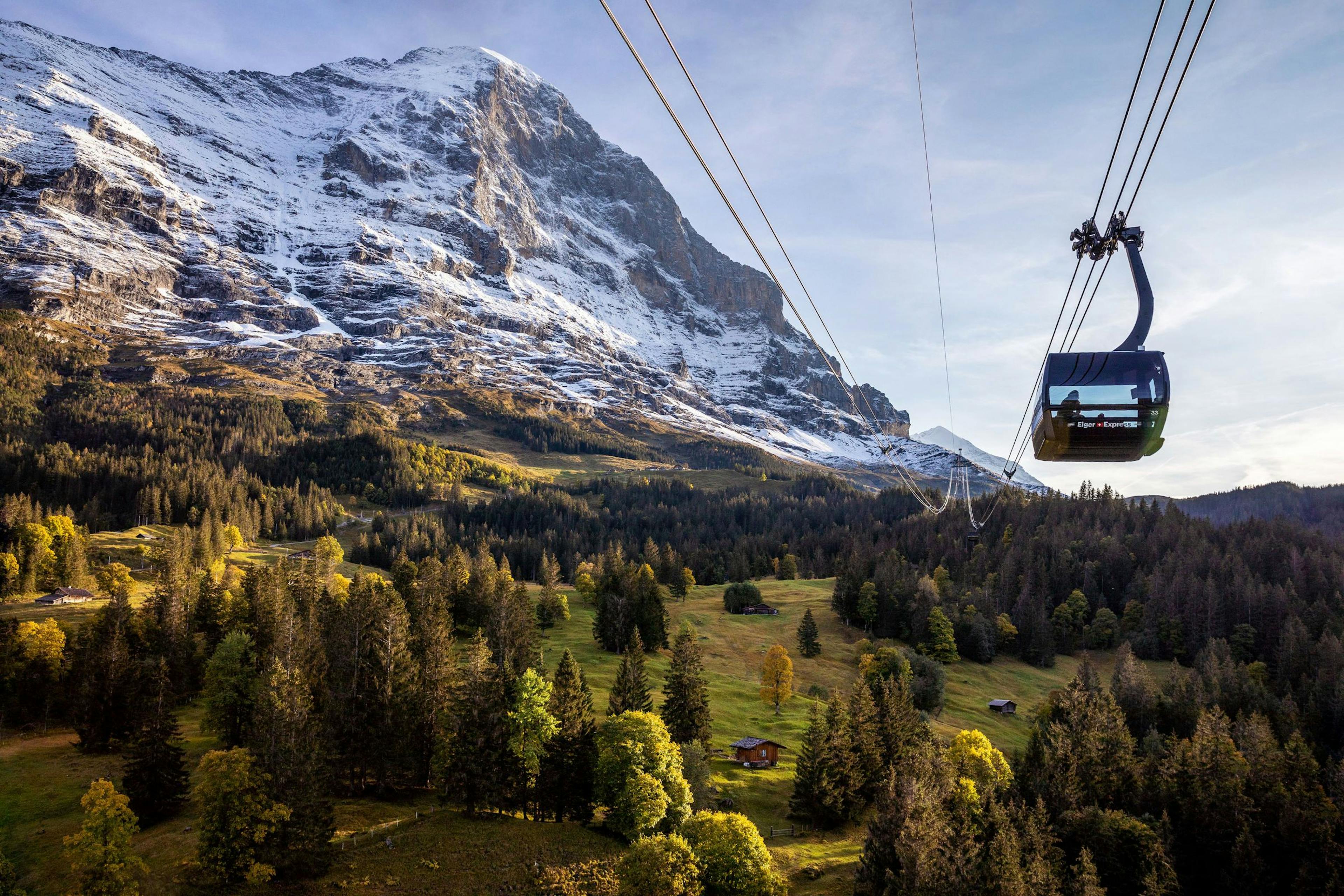
Ticket Eiger Express from Grindelwald terminal

Ticket Männlichen from Grindelwald

Stanserhorn Ticket: Funicular and CabriO

From Wengen: Ticket Männlichen

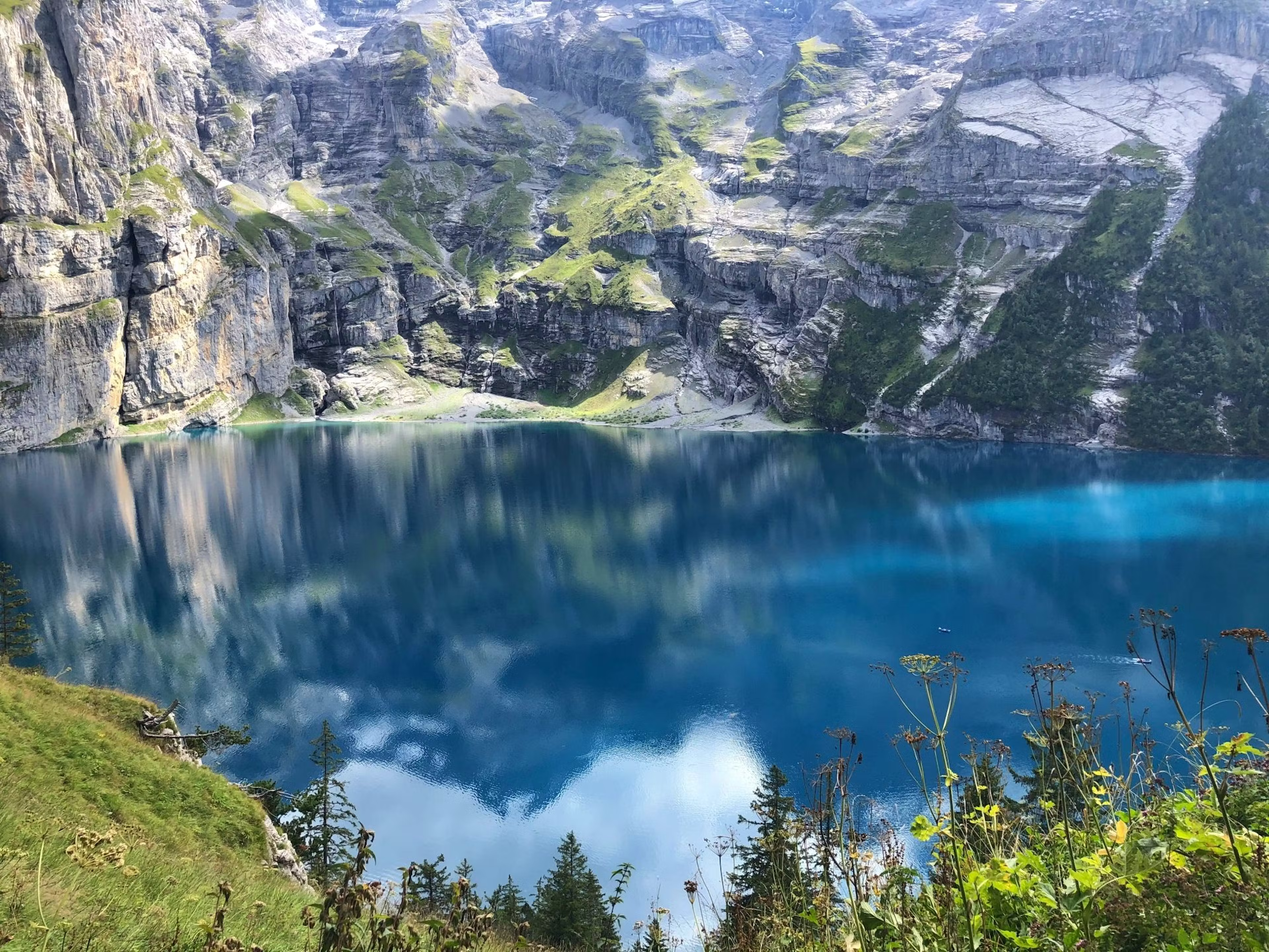
Ticket Oeschinensee cable car from Kandersteg

Ticket
From Interlaken: Ticket Jungfraujoch incl. seat reservation
Validity: All day
booked 6,262 times

Ticket
Likely to sell outFrom Grindelwald: Ticket Jungfraujoch incl. seat reservation
Validity: All day
booked 4,780 times

Ticket
Likely to sell outTicket Grindelwald First - Top of Adventure
Validity: All day
booked 11,728 times

Ticket
Likely to sell outTicket funicular Harder Kulm from Interlaken Ost
Validity: All day
booked 22,271 times
Ticket
Likely to sell outMt. Pilatus self-guided trip by cogwheel train and cable car from/to Alpnachstad or Kriens
Validity: All day
booked 2,716 times

Ticket
Likely to sell outMount Titlis or Trübsee ticket from Engelberg
Validity: All day
booked 1,710 times

Ticket
Likely to sell outFrom Lauterbrunnen: Ticket Jungfraujoch incl. seat reservation
Validity: All day
booked 1,242 times

Ticket
Gornergrat Bahn ticket from Zermatt
Validity: All day
booked 379 times

Ticket
Likely to sell outSchilthorn Ticket from Mürren or Stechelberg
Validity: All day
booked 788 times

Ticket
Likely to sell outTicket Glacier 3000 Les Diableretes from Col du Pillon
Validity: All day
booked 254 times

Ticket
Likely to sell outSchynige Platte Ticket rack railroad from Wilderswil
Validity: All day
booked 1,245 times
Ticket
Likely to sell outTicket Eiger Express from Grindelwald terminal
Validity: All day
booked 986 times

Ticket
Likely to sell outTicket Männlichen from Grindelwald
Validity: All day
booked 528 times

Ticket
Stanserhorn Ticket: Funicular and CabriO
Validity: All day
booked 60 times

Ticket
Likely to sell outFrom Wengen: Ticket Männlichen
Validity: All day
booked 90 times
Ticket
Likely to sell outTicket Oeschinensee cable car from Kandersteg
Validity: All day
booked 74 times
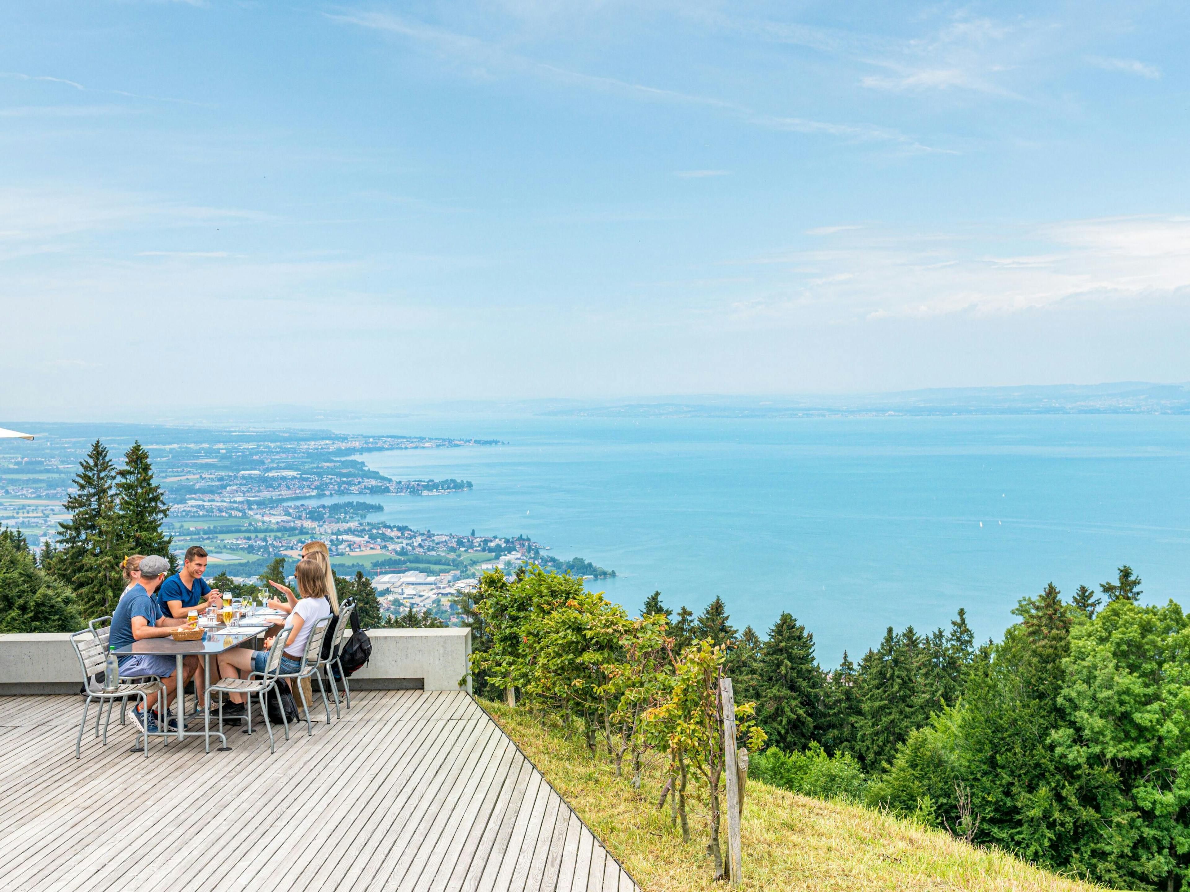
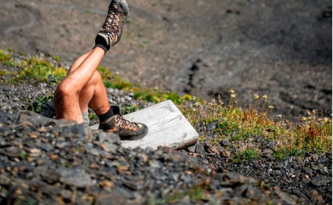
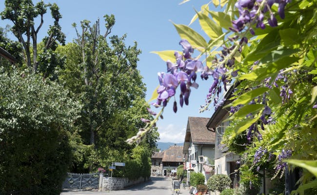
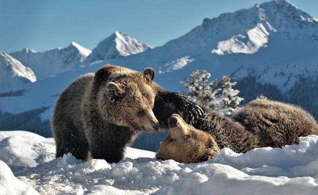
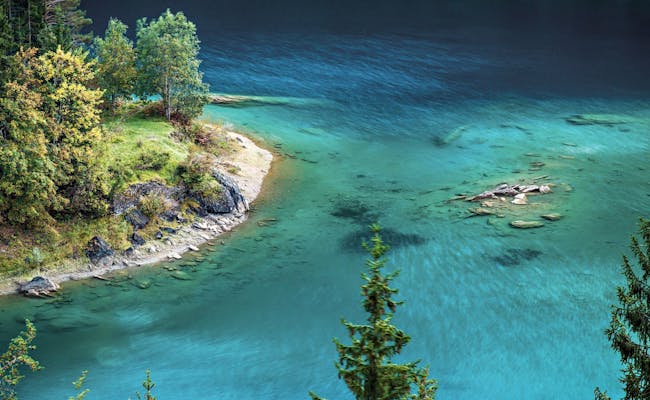
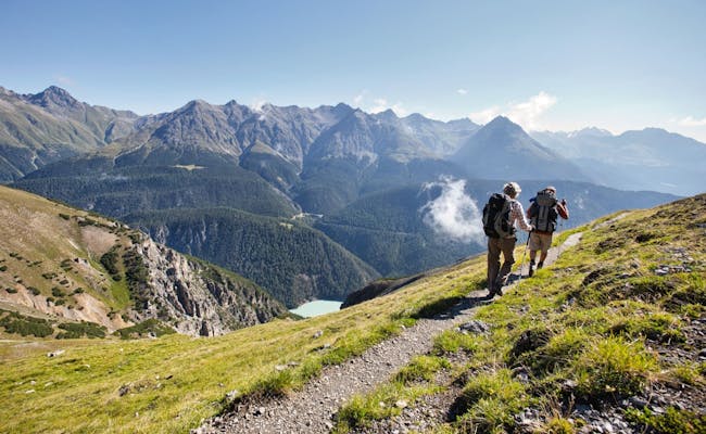
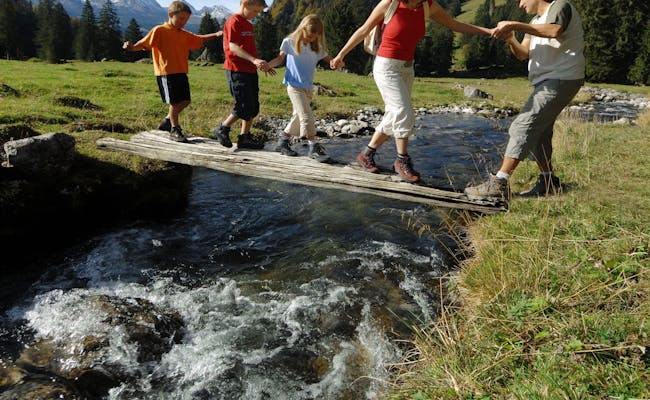
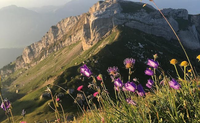
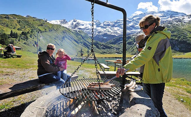
You can hike everywhere in Switzerland. Over 65,000 km of marked hiking trails are available to you. About one third of them are mountain hiking trails. Particularly beautiful mountain hikes can be found in the Bernese Oberland, in the Valais and in the Grisons. On high-altitude and ridge hikes you can enjoy the idyll in the Jungfrau region. The lakes shine green and blue against the backdrop of the mountain peaks with the Jungfrau massif in the foreground
Switzerland's highest mountain peaks accompany you in the Valais region. 41 of the country's 48 four-thousand-meter peaks are located here. The largest network of marked hiking trails is in the canton of Graubünden.
 Via Alpina (Foto: Cecile Kuehn MySwitzerland)
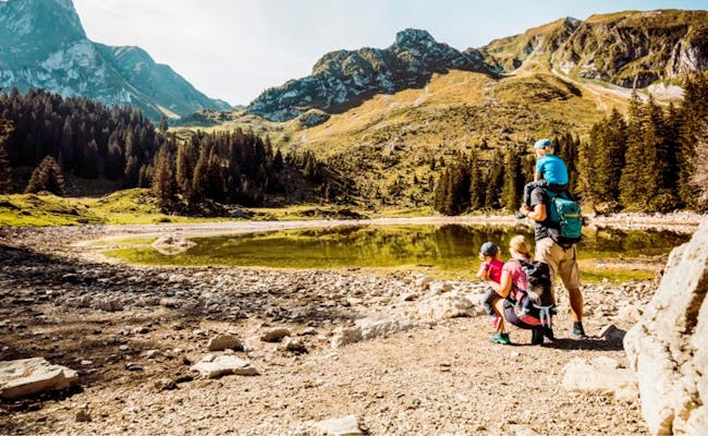 Wandern (Foto: Ivo Scholz MySwitzerland)
I'm sure you'll take lots of great photos of your hiking experiences along the way: Share them with us on Instagram with #swissactivities or @swiss_activies or on Facebook with @Swissactivites.com. That way we can travel with you a little bit...
The marked hiking trails in the individual hiking regions of Switzerland.
| region | marked hiking trails (km) |
|---|---|
| Bern | 10,000 |
| Wallis | 8'000 |
| Graubünden | 11'000 |
| Eastern Switzerland | 7'900 |
| Ticino | 4'400 |
| Central Switzerland | 7'600 |
| Jura | 1'130 |
| Zurich | 3'600 |
| all other regions | 11'370 |
| Total hiking trail network Switzerland | 65'000 |
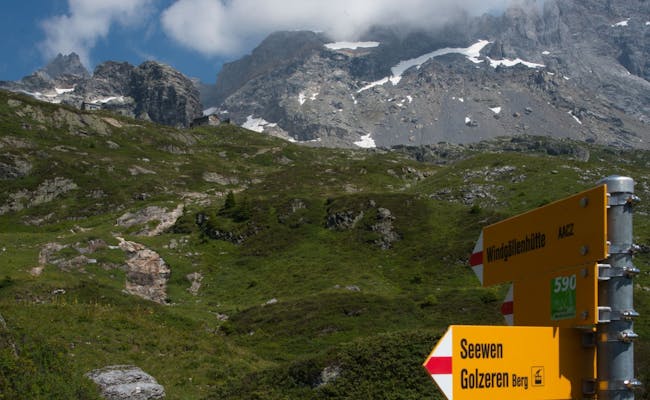
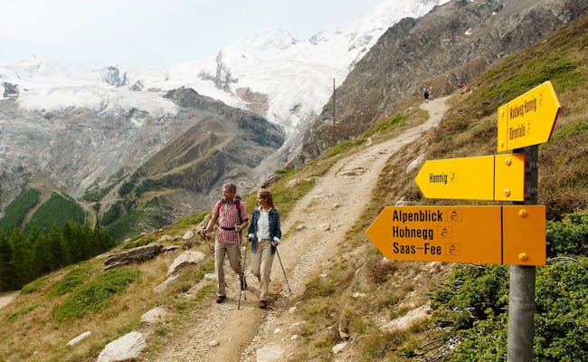
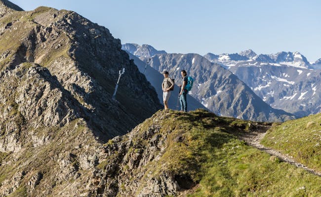
Hiking trails in Switzerland are uniformly marked. Yellow signposts indicate that they are hiking trails. Sometimes a green square with a stylized picture of the destination is shown on them. On well-known hiking trails, the name and number of this trail are also recognizable. Most of the time you will also see on the signposts the altitude of the location as well as the time to reach a certain destination.
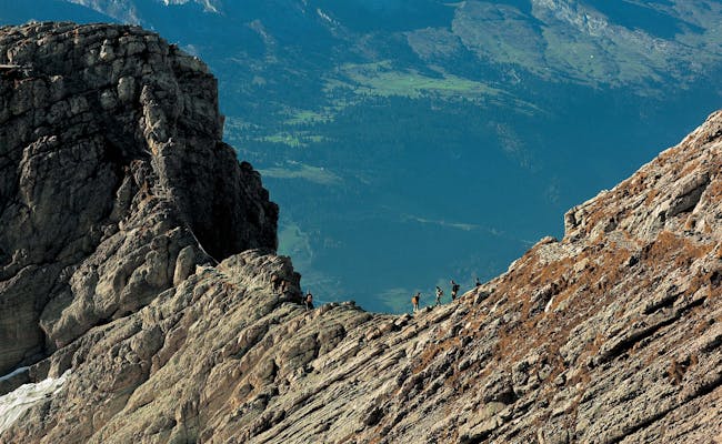
Mountain trails are marked white-red-white, alpine trails white-blue-white. You will also find these colors on rocks, stones and trees. They show you that you are still on the right path
| Trail category | Hiking scale SAC | Marking | Trail condition | Physical condition | (additional) equipment |
|---|---|---|---|---|---|
| Hiking trail | T1 | yellow signpost | mostly wide paths, handrails at drop-off points | normal fitness | sneakers |
| partly with green rhombus or no. as well as named trail designation | steps on steep passages, | ||||
| mountain trail | T2 and T3 | white-red-white | mainly steep trails, partly impassable terrain | no dizziness, sure-footedness, good to very good fitness | good trekking shoes and weatherproof clothing |
| also at the yellow signpost as directional triangle | secured with ropes and chains | ||||
| Alpine hiking trail | T4 to T6 | white-blue-white | Boulders, snowfields, glaciers, pathless | special fitness and alpine experience/training or guided tour with mountain guide | mountain boots, rope, ice axe, crampons, compass |
| Blue signposts with white-blue-white tip, white-blue-white markers | rock with climbing sections without belay |
Wheelchair users can now find 76 marked hiking trails that are suitable for them. Like the local hiking trails, they have a three-digit number. In addition, the signposts bear a wheelchair symbol.
 Bergwanderwege (Foto: Juerg Altwegg, FotoPate Schweiz Mobil MySwitzerland)
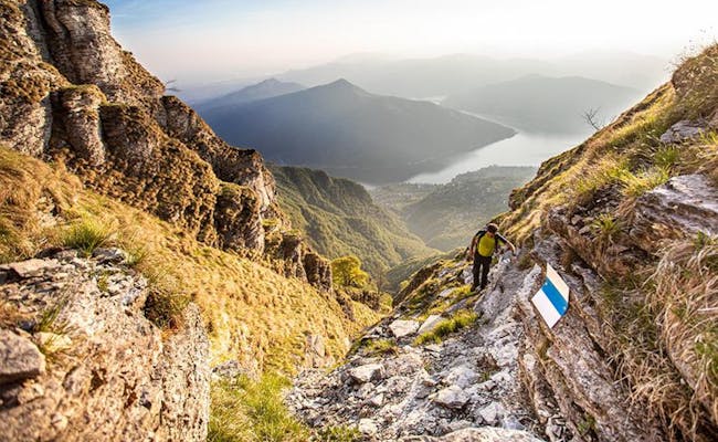 alpiner Wanderweg (Foto: Tessiner Tourismusagentur ATT SA)
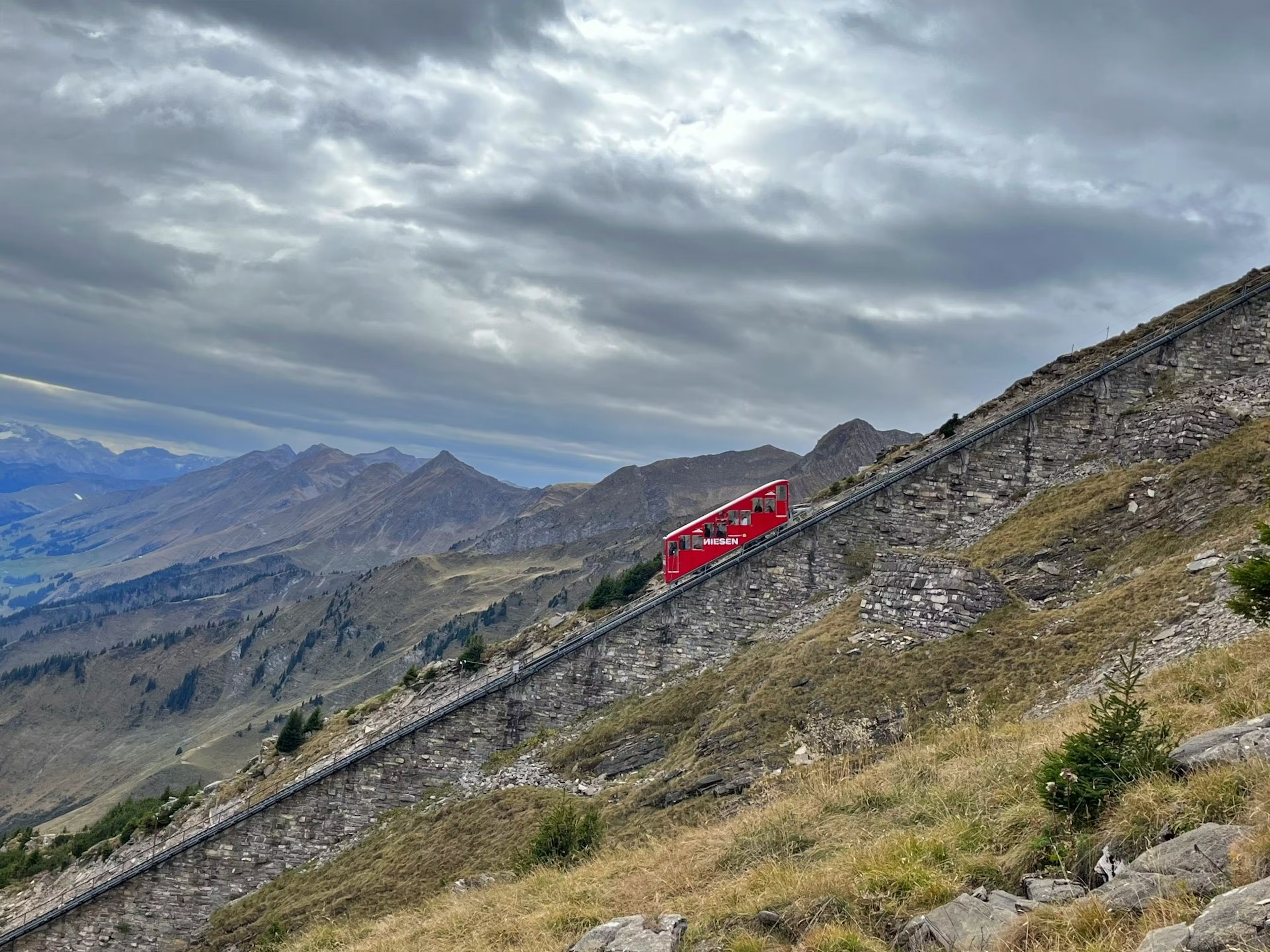
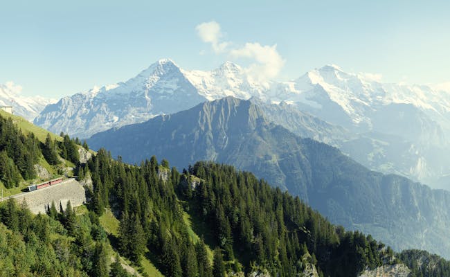
Since hiking is the No. 1 national sport in Switzerland, there are also facilities everywhere to reach the mountains comfortably. Cogwheel railroads, funiculars and aerial cableways take you to the top.
562 mountain railroads and 350 chairlifts exist in Switzerland. Not all of them are open in summer. But most of them are open in summer and let you start your hikes directly in the beautiful mountain landscape. And where there are valley stations of mountain railroads, there is always a post bus or a train.
| quality target | implementation |
|---|---|
| varied routing | about three sights or diversions every 15 min walking time |
| connection to public transport | start and destination directly connected to a public transport stop |
| Consideration of relevant needs/interests in planning | Disconnection with motorized traffic and other non-motorized traffic |
| Use suitable path surface outside settlements during construction | at least 90% suitable path surface |
| impeccable path condition | path condition in a condition corresponding to the path category, also artificial structures |
| uniform signalization | all routes/stages are continuously signalized in both directions; application of uniform regulations |
| Tourism communication | Information on route, hiking times and altitude differences as well as further details via several channels |
Some hikes last only a few hours, others are completed in stages over several days. The choice is yours. Normal hiking trails are often even passable with a stroller
A comprehensive source for national, regional or local hiking routes is Switzerland Mobile. The website lists 362 (7 national, 65 regional and 290 local) routes and includes maps
Our listing shows you three national routes. In the following, however, we concentrate on local and at most one-day hikes.
 Alpenpanoramaweg (Foto: Claudine Sydler, Patin Schweiz Mobil MySwitzerland)
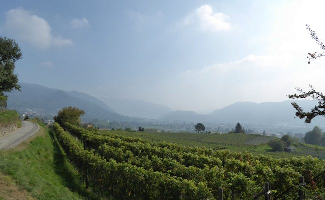 Via Gottardo (Foto: Fritz Kammermann, FotoPate Schweiz Mobil MySwitzerland)
In Switzerland you will find 72 signposted hiking trails that allow you to hike for several days. Of course, you can also choose parts of them. 7 national and 65 regional hiking routes of Switzerland are divided into several stages. One stage usually corresponds to the recommendation for one hiking day.
Three of the 7 national hiking routes of Switzerland can be found here:
Alpine Panorama Trail (3): Rorschach - Trogen - Appenzell - Schwägalp - Amden - Einsiedeln - Unterägeri - Zug - Lucerne - Wolhusen - Napf-Lüderenalp - Moosegg - Münsingen - Rüeggisberg - Guggisberg - Schwarzsee - Jaun - Bogis - Bossey - Geneva
The Alpine Panorama Trail takes you through the foothills of the Alps once across Switzerland. On the way you will meet traditional dairy farms and cheese dairies. Not only the Emmental and the Appenzellerland are known for it. Later, in the direction of western Switzerland, wine-growing tends to dominate. The hiking trails are also good for families.
Via Gottardo (7): Basel - Liestal - Läufelfingen - Olten - Sursee - Lucerne - Altdorf - Wassen - Andermatt - Gotthard Pass - Airolo - Lavorgo - Biasca - Bellinzona - Lugano - Morcote - Mendrisio - Chiasso
The Via Gottardo starts in Basel and on its way to Ticino first runs along the Rhine. The rest of the main route follows the historic route over the Gotthard Pass into the Swiss Alps. At Hospental, an old customs station, the Gotthardreuss and the Furkareuss join. The path across the plateau from Gamssteg is particularly beautiful.
Via Alpina (1): Vaduz - Sargans - Weisstannen - Elm - Linthal - Urner Boden - Altdorf - Engelberg - Engstlenalp - Meiringen - Grindelwald - Lauterbrunnen - Kandersteg - Adelboden - Lenk - Gstaad - L'Etivaz - Rossiniére - Rochers de Naye - Montreux
The Via Alpina leads you through seven cantons of Switzerland and starts in Vaduz in the Principality of Liechtenstein even outside of Switzerland. you will cross 14 of the most beautiful alpine passes on this wonderful mountain trail. On the way you will encounter cultural sites as well as idyllic alps with cows and goats. Finally, you will reach Lake Geneva, which is surrounded by vineyards.
 Via Gottardo (Foto: Jakob Etter, FotoPate SchweizMobil MySwitzerland)
 Alpenpanoramaweg (Foto: Claudine Sydler FotoPatin Schweiz Mobil My Switzerland)
Hiking in the Bernese Alps is associated with a special fascination of the 4000-meter mountains. Finsteraarhorn, Eiger, Mönch and Jungfrau accompany you on your way. The Eiger north face exerts an almost mystical attraction. A quarter of the almost 10,000 km of hiking trails in the region are mountain trails.
Eiger Trail: Grindelwald Eiger glacier mountain railway station (2321 m above sea level) - Grindelwald Alpiglen mountain railway station
The trail marking is a green square on a yellow sign. The square shows the Eiger under the text "Eiger Trail". Start and finish points are mountain railway stations from and to Grindelwald, respectively. You will conquer scree slopes and steep alpine pastures on the way to the Eiger north face. You will be rewarded with a view of the climbers who want to conquer the notorious wall. The view down into the valley is also beautiful. There is a thundering waterfall along the way.
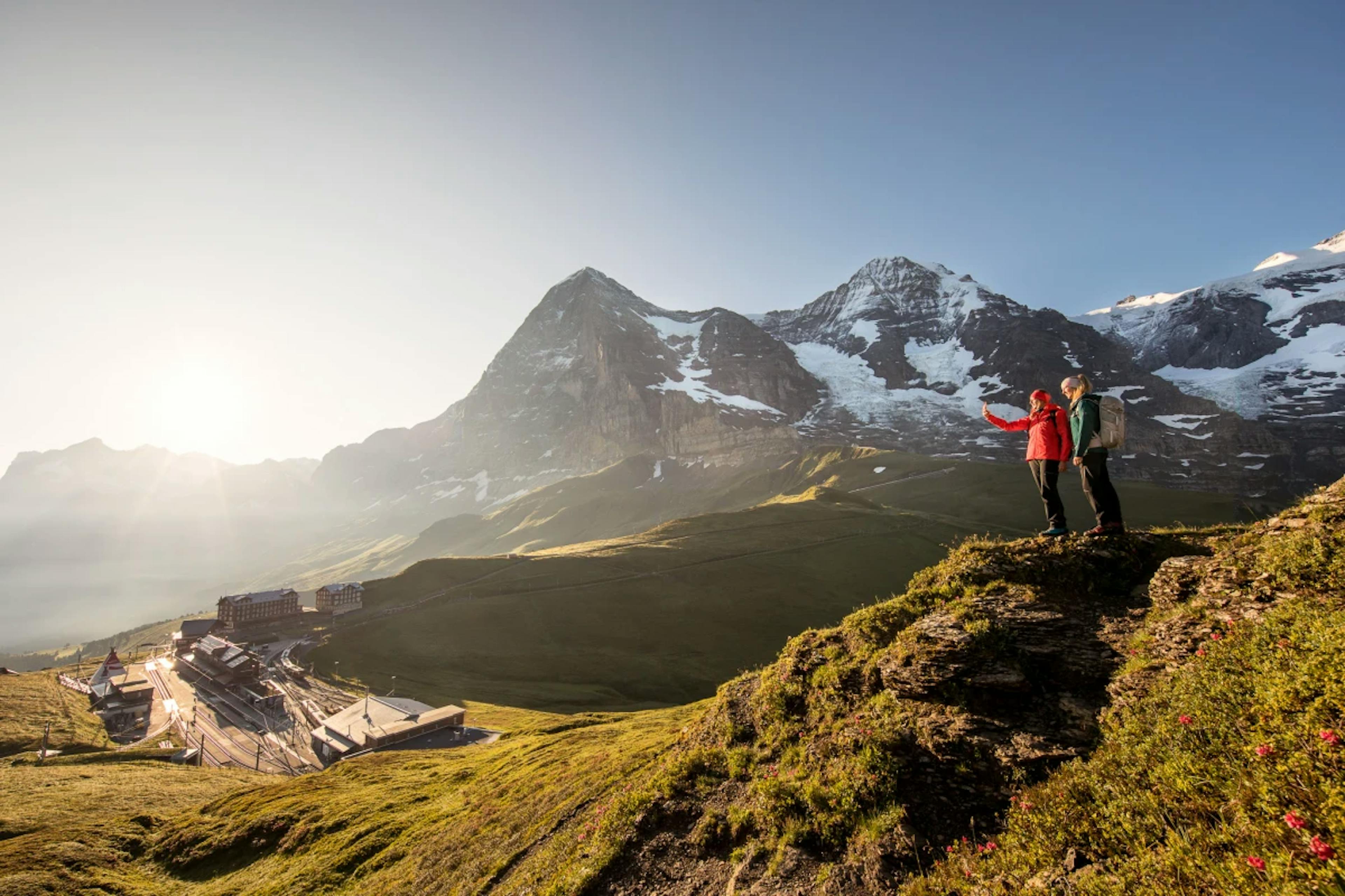
From Männlichen to Kleine Scheidegg: Männlichen mountain railroad station (2222 m above sea level) - Honegg - Kleine Scheidegg rack railroad stop (2061 m above sea level)
This high-altitude trail is very comfortable to walk. It leads almost level through a magnificent mountain landscape. Eiger, Mönch and Jungfrau are in the immediate vicinity and in good weather there are many hikers here.
 Eigertrail (Foto: MySwitzerland)
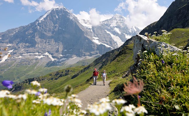 Männlichen Kleine Scheidegg (Foto: MySwitzerland)
Panorama trail Schynige Platte: Mountain station Schynige Platte (1968 m above sea level) - Louchera - Oberberghorn - Tuba - Schynige Platte
The circular trail starts at the mountain restaurant on the Schynigen Platte and leads you to the viewpoint Tuba. You can hike well over alpine paths, pastures and trails. A short metal staircase brings you to the ridge. On the way you have a particularly beautiful view of the Eiger, Mönch and Jungfrau. At Tuba you can see the lakes of Thun and Brienz as well as the Brienz ridge.
High altitude hike Schynige Platte: Mountain railway station Schynige Platte (1968 m above sea level) - Oberberg - Loucherhorn - Egg - Faulhorn - Bachalpsee - First
This mountain hike starts at the mountain station of the rack railroad on Schynige Platte. Via the Oberberg you reach the western slope of the Loucherhorn. On the way you will experience the contrast of a barren karst landscape to the deep blue Lake Brienz. Eiger, Mönch and Jungfrau accompany you as a backdrop. The view from the Faulhorn, whose summit you can climb without any alpine skills, is particularly beautiful. From the First, the cable car takes you down into the valley to Grindelwald.
 Schynige Platte Eigernordwand Mönch (Foto: Jungfraubahnen)
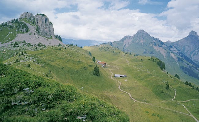 Schynige Platte (Foto: Jungfraubahnen)
Mürren Grauseeli Loop: Mürren - Allmendhubel - Schilthornhütte - Birg - Grauseeli - Schiltalp - Suppenalp - Mürren
From Mürren you hike over the Allmendhubel to the Schilthornhütte. The path is partly steep and stony. Through the Engetal you come to the Grauseeli. The further way to Schiltalp is very demanding. Via Suppenalp to Mürren it becomes easier again. The way to Grauseeli can be shortened rapidly to 2 hours if you use the Schilthornbahn to and from Birg.
Mürren Allmendhubel: Mürren - Blumental - Allmendhubel
The trail is suitable for baby carriages on the entire route. At the beginning you have to cope with a slope. At Allmendhubel you will find the Flower children's playground. On the Flower Trail you will find more than 150 mountain flower species. The way back to Mürren you can easily manage with the funicular.
 Grauseeli (Foto: Schilthornbahnen)
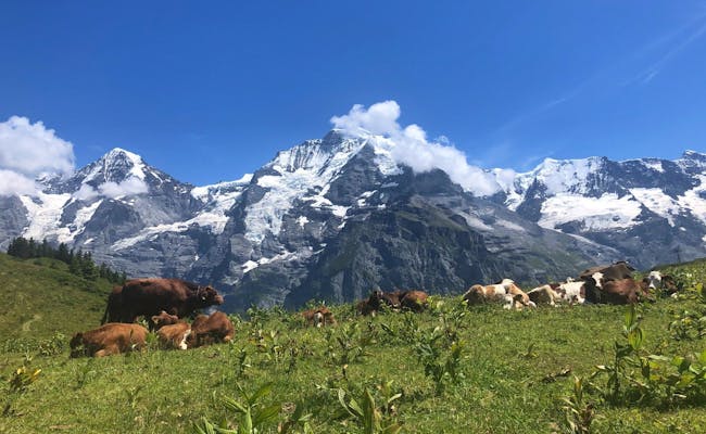 Mürren (Foto: Seraina Zellweger)
Heuberg: Oeschinensee mountain station - Oeschinensee - Kandersteg
From Kandersteg you take the cable car up to the mountain station near Lake Oeschinen. Here the panoramic trail starts above the largest mountain lake in Switzerland and you get a fantastic view of the deep blue Oeschinensee. On the way you will pass waterfalls and streams before you arrive at the lakeshore. From here you hike back to Kandersteg.
 Oeschinensee Ralligen (Foto: Seraina Zellweger)
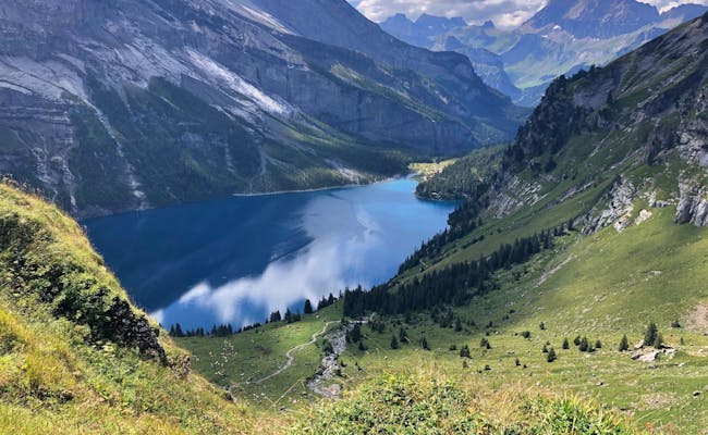 Oeschinensee (Foto: Seraina Zellweger)
Gantrisch Panorama Trail (379): Plaffeien Zollhaus near Plaffeien - Hällstett - Horbüelpass - Pfyffe - Gägger - Gurnigelbad
A steady ascent begins right at the Zollhaus, for which a very good physical condition is important. The hiking trails are well developed and signposted. You are in the Gantrisch Nature Park and in several protected areas of national importance. A highlight is the Gäggersteg, where you are guided over wooden footbridges. The Panorama Trail is considered a particularly beautiful trail in the Bernese Pre-Alps and can also be ended at the Gurnigel Berghaus (5 km shorter).
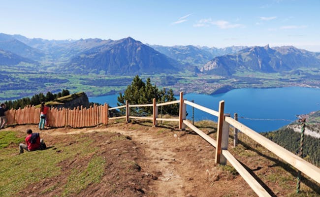
Niederhorn Panorama Trail (342): Niederhorn mountain station (1939 m above sea level) - Güggisgrat - Chüematte - Waldegg
The hiking trail starts at the mountain station of the Niederhorn cable car in Beatenberg. It leads on natural paths over the Güggisgrat as well as through pine forests and is very popular. The Lake Thun and the 4000m peaks of the Jungfrau region form the panorama. On the way you can observe chamois or marmots. Surefootedness and a head for heights are indispensable prerequisites for this easy tour.
Adelboden Tschentenalp: Adelboden village (1349 m a.s.l.) - Fluhweide - Chemisalp - Tschentenalp mountain station
On pleasant paths the hike leads across meadows with alpine herbs and through a pine forest. On the way you look into the impressive mountain world of the Stiegelwand. Arrived at the Tschentenalp, you have a view of the Lohner massif, the Tschingellochtighorn and the Wildstrubel.
 Gratweg Niederhorn (Foto: Niederhornbahnen)
 Tschentenalp (Foto: Tschentenalpbahn)
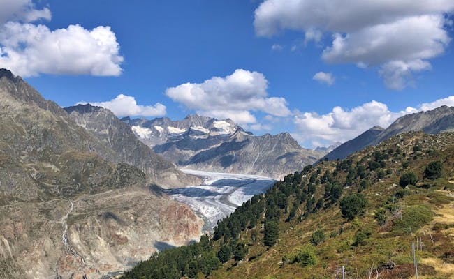
When hiking in Valais, you are constantly surrounded by mountain giants. The striking Matterhorn, the Breithorn and the Allalinhorn are among the most famous of the 41 four-thousand-meter peaks in the Valais. The huge Aletsch Glacier and the Rhone Valley with its vineyards also offer beautiful hiking opportunities.
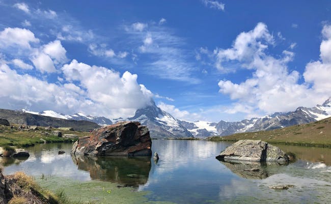
5 Lakes Hike Zermatt (186): Blauherd Mountain Station (2571 m above sea level) - Stellisee - Grindjisee - Grünsee - Moosjisee - Leisee - Sunnegga Mountain Station
Take the mountain railroad from Zermatt to the mountain station Sunnegga and continue with the gondola to the mountain station Blauherd. Here the hike begins. On the way, the Matterhorn is reflected in the three lakes Stellisee, Grindjisee and Leisee. At the Leisee you can swim and for the children there is a playground. For the last part from the Leisee to the mountain station Sunnegga you can also take the Leisee shuttle.
Riffelsee trail from Rotenboden to Riffelberg: Rotenboden mountain station (2815 m above sea level) - Gagenhaupt - Bruder Klaus chapel - Riffelberg station (2563 m above sea level)
With the Gornergrat cable car you reach the mountain station Rotenboden. This is where the popular hiking trail begins. Alpinists start their tours to Monte Rosa Hut or Gorner Glacier here. The hike to the Riffelberg leads past the Riffelsee and a second smaller lake. The Matterhorn is reflected in both lakes.
 Zermatt (Foto: Seraina Zellweger)
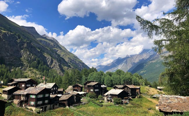 Zermatt (Foto: Seraina Zellweger)
Gemsweg Saas Fee (183): Hannig Saas Fee mountain station (2339 m above sea level) - Saas Fee bus terminal
The hike starts at the station of the mountain railroad to Hannigalp. It leads along the spectacular glacier landscape and the glacier lake to the restaurant Gletschergrotte. From here you follow a historic Suone (irrigation canal) to the bus terminal in Saas Fee.
Almagelleralp (159): Saas Grund Kreuzboden (2400 m above sea level) - Triftgrätji - Almagellertal - Saas Almagell (2194 m above sea level)
With the cable car you reach the mountain station Kreuzboden from Saas Grund via Trift. Here at the idyllic mountain lake you start the hike to the viewpoint Triftgrätji. On the way you can admire 240 alpine flowers. A high-altitude hike leads to the Almagellertal to the Almagelleralp. Afterwards you walk along the stream to Saas Almagell.
 Saas Fee Hannig (Foto: Saastal Tourismus AG)
 Saas Fee Allmagelleralp (Foto: Saastal Tourismus AG)
Aletsch Panorama Trail (39): Riederalp - Riederfurka - Lake Märjelen
You start the trail in the Aletsch Arena at Riederfurka near Villa Cassel. Via the moraine path you walk along the border of the Aletsch forest with a view of the mighty Aletsch glacier. The Aletsch Glacier belongs to the UNESCO World Natural Heritage. To Hohbalm the path is particularly steep. Before you get to the Märjelensee, you can already see the Mönch and the Jungfraujoch.
For hiking at the Aletsch Arena, it's best to use the Aletsch Arena Entdeckerpass
Binntal Schaplersee trail (192): Fäld - Mässerchäller - Schaplersee - Binn
This circular trail leads through the Binntal Landscape Park. It is known for its minerals and untouched nature. The tour to the Schaplersee starts at the village Fäld, in Binn or at the Heiligkreuz. The part of the trail that zigzags from Haufenweiler through to the Nackewald is difficult. The Schaplersee is located at 2237 m above sea level in a basin.
 Aletschwald (Foto: Seraina Zellweger)
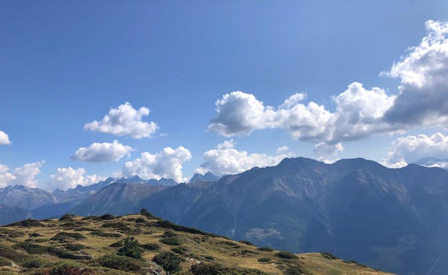 Aletschwald (Foto: Seraina Zellweger)
Hiking in Graubünden is associated with beautiful scenery. You will find no less than 11,000 km of marked hiking trails here, making Graubünden an absolute hiker's paradise.
Panorama trail Davos: Schatzalp mountain station (1861 m above sea level) - Strelapass - Panorama trail - Parsennhütte - Stützalp - Wolfgang
Strictly speaking, only a part of this hiking trail actually has the designation "Panoramaweg". It connects the Strelapass with the Parsennhütte. Nevertheless, the entire trail above Davos is beautiful. You can reach the Schatzalp in four minutes from Davos with the Schatzalpbahn. From Wolfgang a bus brings you back. The path leads mostly over alpine pastures.
About Jenisberg to Filisur: Wiesen Station Bahnhof (1197 m a.s.l.) - Jenisberg - Schönboden - (detour to the Greifenstein ruin) - Knappenweg - Filisur
From Wiesen station you hike over Jenisberg to Schönboden. The Knappenweg is then a bit more difficult to walk. The ruin Greifenstein can only be reached with climbing equipment. Under the railroad viaduct of the Rhaetian Railway you reach Filisur.
 Davos (Foto: Destination Davos Klosters Martin Bissig)
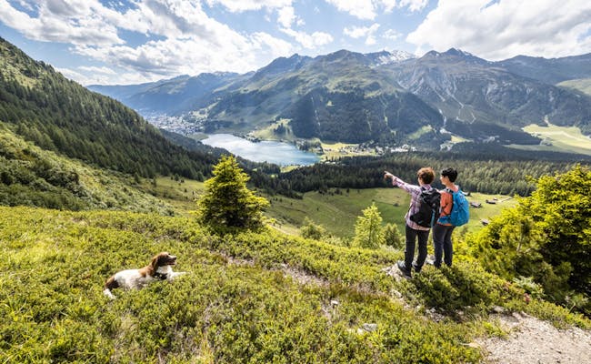 Davos (Foto: Destination Davos Klosters Martin Bissig)
Globi hiking trail: Val Sporz valley station - Lenzerheide - Val Sporz valley station
The Globi hiking trail begins and ends at the top station of the Tgantieni chairlift, which departs from Val Sporz. It is primarily designed for families with children. At 13 stations, boards explain topics from nature and technology in a playful way. Part of this trail (in the direction of the reservoir) is accessible with an all-terrain stroller.
Parpaner Rothorn: Valbella/Lenzerheide near the Rothornbahn valley station (1479 m above sea level) - Scharmoin - Parpaner Rothorn (2854 m above sea level) - Valbella/Lenzerheide
This circular hike is a mountain tour with particularly beautiful views above the Heidsee. The long tour can be shortened with the mountain railroad (middle station Scharmoin) or summit station (Rothorn).
 Globi Wanderweg (Foto: MySwitzerland)
 Lenzerheide (Foto: Ferienregion Lenzerheide)
Arosa Weisshorn Trail (766): Arosa middle station Weisshornbahn (2010 m above sea level) - Sattelhütte - Weisshorn - Carmennahütte - Arosa
The ascent begins at the middle station of the mountain railroad and leads over pleasant meadow and moorland past the Brüggerhorn to the Weisshorn summit. The view goes into the valley Schanfigg. Between Sattelhütte and Weisshorn there is scree to overcome. At the top you enjoy a panoramic view. The further path leads back to Arosa as a descent.
Round hike Ochsenalm: Sunstar Hotel Arosa (1736 m above sea level) - Ochsenalm - Kuhweide - Weisshornbahn / Arosa Bärenland - Sunstar Hotel Arosa
The trail first leads to the Eichhörnliweg, from where you can see the Ochsensee below you. The rest of the way alternates between gravel roads, asphalt roads and mountain paths. The hike thus requires a decent level of fitness. The free-roaming cows along the way should not be stroked, it could be dangerous. The Arosa Bärenland is also on the way. Here you could stop the hike and take the cable car back to Arosa. This way you save about an hour of hiking time.
 Wandern Weisshorn Arosa Baerenland (Foto Arosa Tourismus)
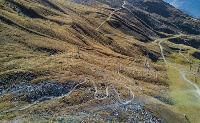 Wandern Weisshornspeed (Foto Arosa Tourismus)
Auenweg (656.2): Ilanz - Castrisch - Valendas-Sagogn - Ilanz
From a large parking lot in Ilanz you hike along the Vorderrhein through the Rhine Gorge. The "Ruinaulta", as the gorge is called in Romansh, is a UNESCO World Heritage Site. On this hike you will pass through several nature reserves and secluded floodplain forests. Paths, gravel paths and nature trails alternate. You can shorten the route with a ride on the Rhaetian Railway.
Tuora (656.3): Flims Waldhaus - Salums - Conn - Lake Cauma - Flims Waldhaus
In the direction of Conn, the circular trail offers a view of the Rhine gorge below you from the viewing platform "Il Spir". At the Caumasee you can swim, if the temperatures allow it. The natural paths and trails are interrupted by a stretch of road and a gravel path in the direction of Conn.
 Rheinschlucht (Foto: My Switzerland)
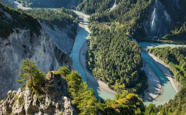 Rheinschlucht (Foto: Gaudenz Danuser My Switzerland)
Including wildlife watching and fondue fun, an unusual guided hike to Val Sinestra near Valsot in the Engadine will take you.
National Park Panorama Trail (45): Vallun Chafuol (1693 m above sea level) - Murter - Chamanna Cluozza - Prasüra - Zernez
Hiking along paths in the middle of the Swiss National Park, you will get a good insight into the wilderness of Switzerland. The pass of Murter lets you look down into the wild gorge of Cluozza. Postbus 262 runs between Zernez and Vallun Chafuol. Please note that you are not allowed to light fires or leave the hiking trail in the national park.
Segantini hut: Muottas Muragl (2454 m a.s.l.) - Munt da la Bês-cha - Segantini hut - Alp Languard
On the tracks of the Swiss painter Segantini you hike from Muottas Muragl in the Engadin first slightly downhill. The path then leads in serpentines to the Segantini hut. The Bernina massif and the Engadine lake plateau can be seen excellently from here. Up to Alp Languard you stay at about the same altitude. From here you can reach Pontresina in a few minutes by chairlift.
Round trip Scuol - Sent: Scuol Postbus stop Clozza - Chauennas - Sent - Tuffaloras - Scuol Postbus stop Clozza
The circular trail scores with a beautiful view and easy walkability. The striking church spire of the village of Sent is already visible from afar and tempts you to take a detour. Sent has numerous village fountains and beautiful Engadine houses with sgraffito facades.
 Engadin NP Panoramaweg (Foto: Nico Schaerer MySwitzerland)
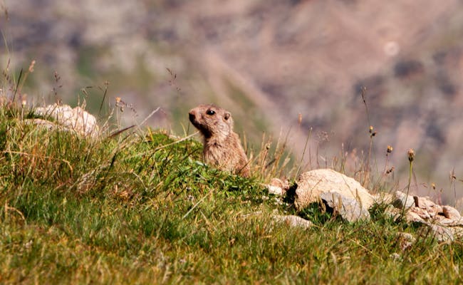 Wildbeobachtung (Foto: Engadin Samnaun Val Müstair)
In Eastern Switzerland you will find beautiful hiking trails in the hiking areas Alpstein (Appenzellerland/Toggenburg) and Churfirsten (Toggenburg). Lovely hills with mountain inns, but also gorges with steep rock faces and low-lying Töbel characterize the area in Appenzellerland.
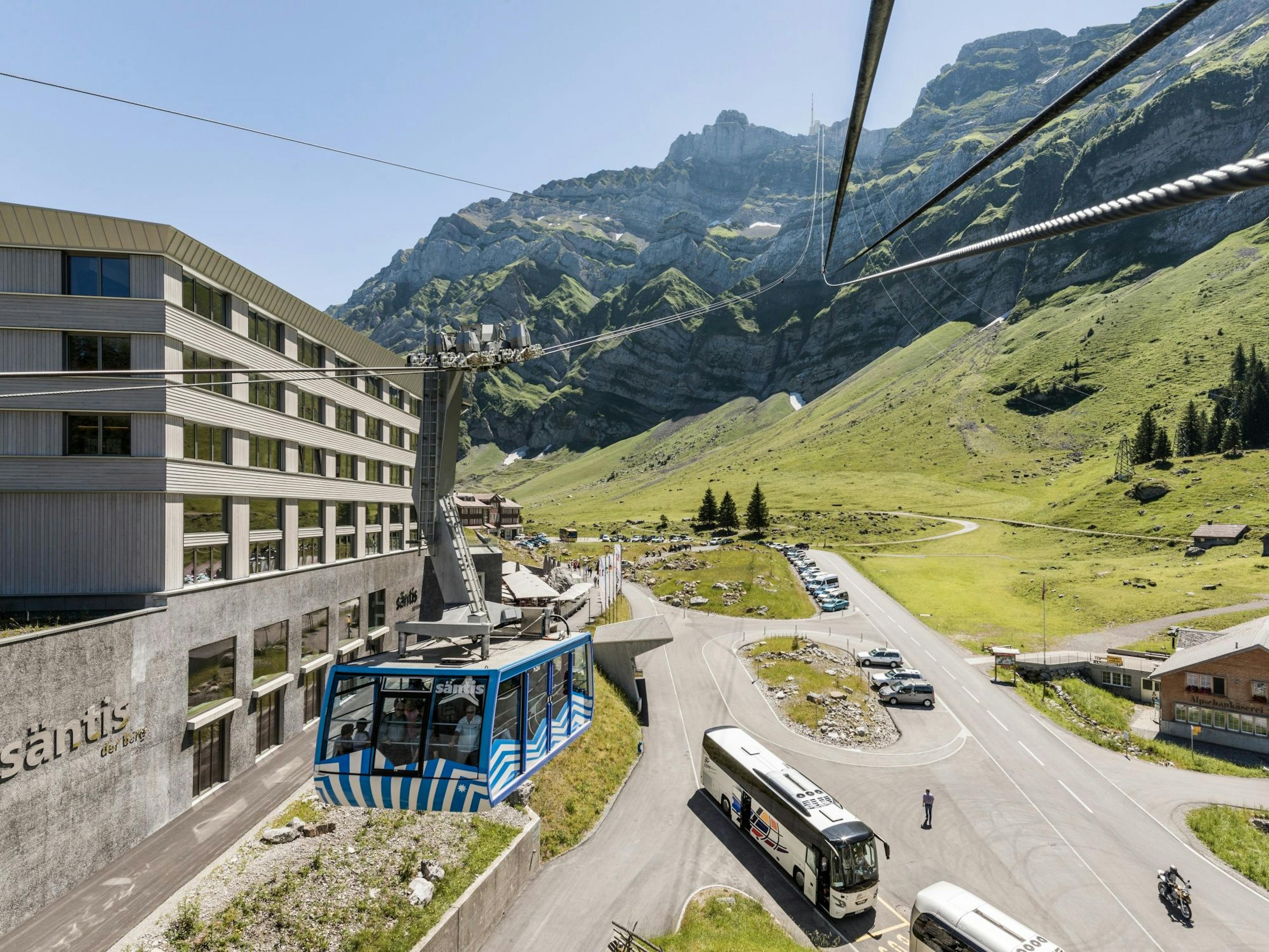
You can reach the Säntis, the "King of the Alpstein", on three different hiking trails between 3 and 6.5 hours. All three are difficult mountain hikes requiring absolute surefootedness. We present you the shortest way.
Schwägalp - Säntis: Schwägalp (1344 m a.s.l.) - Gmeinenwisen - Musfallen - Tierwis - Girensattel - Säntis (2473 m a.s.l.)
The trail starts at the valley station of the Säntis cable car in Schwägalp, where you can park for free. You can also get to Schwägalp by post bus. The path goes up steeply right away. Between the rock bastion Musfallen and the mountain inn Tierwis you hike directly along a rock face. Steps and footholds make the way easier. To reach the summit, you walk between funnels and crevasses and climb the so-called Himmelsleiter (ladder to heaven). For the way back you use the mountain railroad.
Schwägalp - Kronberg: Schwägalp - Chammhaldenhütte - Langälpli - Kronberg - Schwägalp
The Kronberg seems almost small next to the Säntis. The mountain hike is nevertheless a panoramic experience. The section from Langälpli to the viewing platform is particularly steep. At the valley station of the Säntis mountain railroad (Schwägalp) you can park for free. The post bus also goes here. You can shorten the tour by taking the cable car from Kronberg down to Jakobsbad. From there a train goes to Appenzell or Gossau. From November to March this hiking trail is passable with snowshoes.
 Säntis (Foto: Philipp Giegel MySwitzerland)
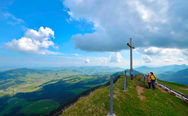 Kronberg (Foto: Christian Perret Appenzellerland Tourismus MySwitzerland)
Weg des Wassers im Obertoggenburg: Gamplüt - Stein - Älpli - Chüeboden - Thurfälle - Unterwasser - Alt St. Johann
With the post bus you can easily get to Wildhaus Dorf and take the cable car up to the Gamplüt. The hike starts in the high and low moorland area and takes you past the impressive Thur waterfalls. The post bus takes you back to Wildhaus from the destination Alt St. Johann (Unterwasser).
Through the linden forest on Lake Walen: Amden-Lehni (638 m above sea level) - Betlis - Seerenwald - Quinten
The hike runs pleasantly through a linden forest along the Walensee. On the way you also come across some sunny terraces. Amden-Lehni can be reached by post bus from Ziegelbrücke. From Quinten it is best to take the boat to Murg.
 Thurfaelle (Foto: MySwitzerland)
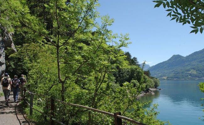 Walensee vor Quinten (Foto: MySwitzerland)
Geniesserroute: Flumserberg Tannenboden (1392 m above sea level) - Molseralp - Chrüz - Alp Tannenboden - Molseralp
From Flums you can easily get to Tannenboden by bus 441. The hike starts at Molseralp next to the valley station of the cable car. If you want to do a culinary hike, you start at Molseralp. Main course would be in Chrüz and dessert in the Sennenstube on the alp Tannenboden. The way to the mountain station Chrüz takes about one hour. Alternatively, you can take the summer toboggan run downhill from Chrüz.
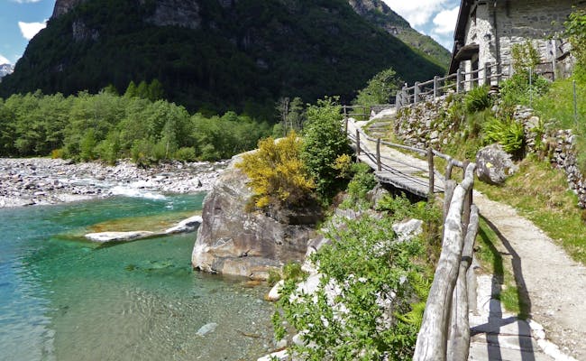
In Ticino there are beautiful lake landscapes and impressive mountain valleys. In the northwest you will find particularly interesting and varied hiking opportunities in the Maggia Valley and the Verzasca Valley. There are routes through the white water or hiking trails that lead from the valley up to 3000 m above sea level. On the way you will pass imposing stone bridges, old villages or hiking trails carved into the rock.
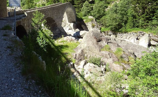
Sentiero Verzasca (74) Stage 1: Sonogno - Lavertezzo
A hike through the stone-rich landscape of the Verzasca Valley is very eventful. The Ponte dei Salti (stone arch bridge) in Lavertezzo is famous, worth seeing and very well visited especially in summer and on weekends. By the way, the often used name "Roman bridge" is wrong. This bridge with two curved stone arches was built only in the 17th century. The post bus serves both Sonogno and Lavertezzo.
Giro Della Valle del Salto (611): Piazza in Maggia - Piazza in Maggia
The Valle del Salto is a shady valley with chestnut and birch trees. You walk along the Maggia river and pass pretty houses, wine terraces and small churches. The village of Maggia is situated in an almost untouched mountain environment. The circular walk starts and ends in the village of Maggia, which you can reach from Locarno by bus line 315.
Monte Tamaro - Monte Lema: Monte Tamaro (1530 m a.s.l.) - Capanna Tamaro - Monte Lema
The high trail is a very popular mountain hiking trail. It starts at the top station of the cable car at Alpe Foppa. You can reach it from Rivera at Monte Tamaro. Via the Capanna Tamaro you go over the saddle to Monte Lema. Here the cable car of Monte Lema will take you down to Miglieglia. In the late afternoon a shuttle service connects the two valley stations.
 Wandern Verzascatal (Foto: Beatrice Nuenlist, Markus Capirone, Velobuero MySwitzerland)
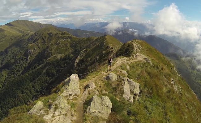 Monte Tamaro Höhenweg Monte Tamaro - Monte Lema (Foto: Tessiner Tourismus AG)
Monte Generoso: Monte Generoso - Alp Nadigh - Alp Génor - Monte Generoso
The circular hike starts at the top station of Monte Generoso and leads you first to its summit. Afterwards you will reach the alps Nadigh and Génor. On the way you will have the opportunity to see eleven of the Nevère (ice pits) alone. Note the last ride of the rack railroad that goes down for about 40 min (Capolago on Lake Lugano).
Mountain hiking in Central Switzerland is associated with a special view of the lake landscape with the Vierwaldstättersee. The mountains are well served by mountain railroads and many a hike can be combined with a boat trip.
From Alpnachstad to Pilatus: Alpnachstad valley station - Amsigen - Pilatus Kulm
The hike up the Pilatus leads you at the beginning along the steepest cog railroad in the world. Later you hike through shady forest. Countless hairpin bends and a scree slope have to be mastered before reaching the summit.
Weg der Naturschätze: Rigi Kaltbad (1423 m above sea level) - Rigi First - Unterstetten - Glettialp - Hinterbergen
Rigi Kaltbad can be reached from Weggis by cable car or from Vitznau by rack railroad. At the beginning you walk along an old railroad line. Between Rigi First and Unterstetten there is a rocky path. 12 information boards tell about the natural treasures from Rigi First. All in all, the hike is easy to manage. In addition, there are always places to sit along the way. From Hinterbergen you take a small cable car back to Vitznau. The train runs 24 hours/day if necessary.
Rigi Blumenpfad: Rigi Staffel (1603 m a.s.l.) - Rigi Staffelhöhe - Rigi Känzeli - Rigi Kaltbad - Rigi First - Felsenweg
You can reach the Rigi Staffel with the rack railroad from Vitznau or from Goldau. The hike is very easy and does not require any special physical condition. You will find seats everywhere. For the return trip you can use the mountain railroad again from Rigi Wölfertschen First.
Hiking with the Rigi Bergbahnen is very relaxing. Nine railroads run regularly to the Rigi, two of which are cogwheel railroads.
 Wandern Pilatus Blumenpfad (Foto: Pilatusbahnen)
 Rigi (Foto: MySwitzerland)
Culinary hike on Klewenalp: Klewenalp (1603 m a.s.l.) - Niederrickenbach place of power
From Beckenried you take the cable car to Klewenalp. A leisurely hike brings you on the way for culinary delights to the Brisenhaus SAC and later to the Pilgerhaus Niederrickenbach. From there you can take the cable car down to Dallenwil (connection to bus/train).
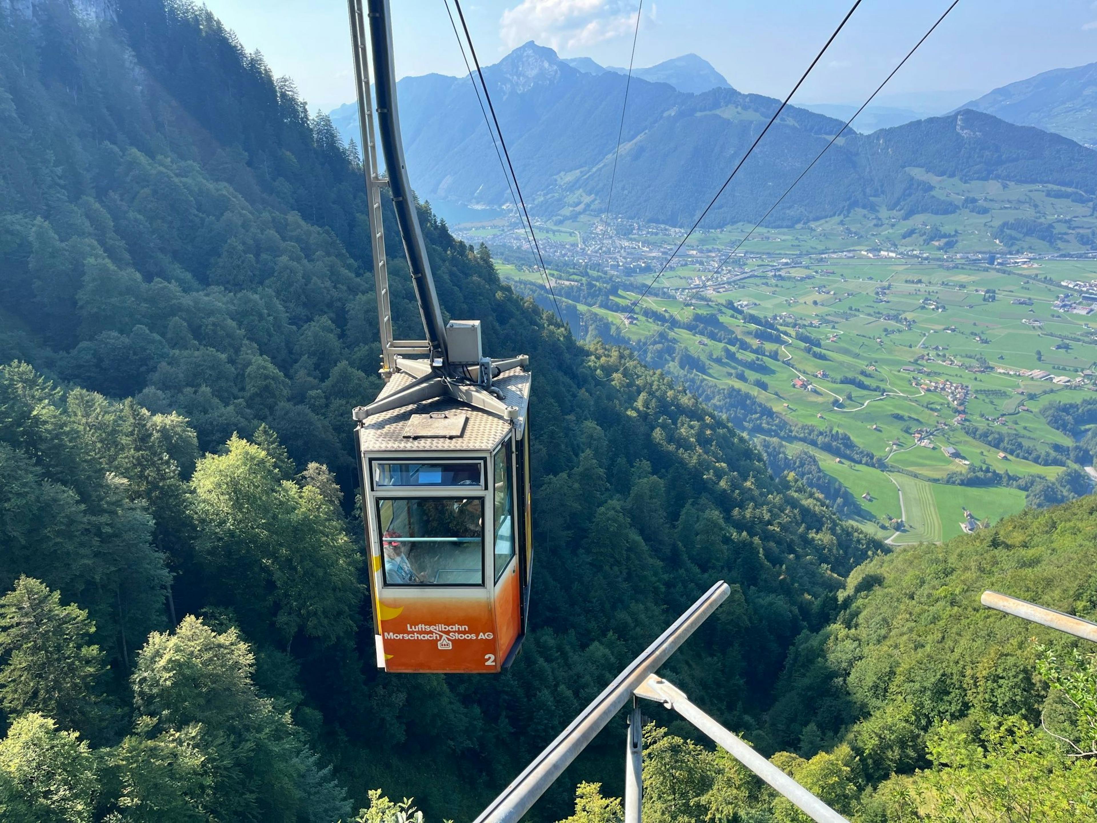
From Stoos to the Muota Valley: Stoos mountain station (1603 m above sea level) - Metzg - Wannentritt - Höch Weidli - Muota Valley
You reach the top station of the Stoosbahn with an unusual funicular from Schwyz. Through the forest with karst rocks and over alpine pastures you hike along trails with changing views. The Höch Weidli, for example, is a natural viewing balcony from which you can look down into the Muota valley.
 Luftseilbahn Beckenried Klewenalp (Foto: Perretfoto.ch MySwitzerland)
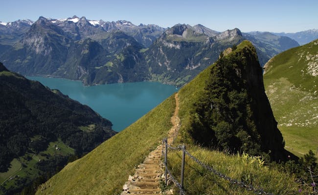 Gratweg Stoos (Foto: Beat Müller My Switzerland)
Round tour on Bürgenstock: Kehrsiten mountain station - Bürgenstock (864 m above sea level) - Taverna - Bürgenstock - Chänzeli - Hotel Villa Honegg - Bürgenstock mountain station funicular railroad
The round trip starts and ends at the mountain station of the funicular railroad that goes up from Kehrsiten to the Bürgenstock. For a day trip, the combination with a boat trip from Lucerne is a good idea.
Stanserhorn: Stans - Chälti - Bluematt - Stanserhorn
There are various routes from Stans to the Stanserhorn. The more difficult ascent is via Chälti and Bluematt. Thereby you go directly over a particularly steep path to the top. Via Luegeren the ascent is less strenuous. Once at the top, a magnificent panorama of a total of 10 lakes and numerous mountain peaks of the whole of Switzerland awaits you. In the south you can see the Glarus, Uri and Obwalden Alps. You can also see the Eiger, Mönch and Jungfrau. In the north, you can see across the Mittelland to the Jura chain. Even the Black Forest and the Vosges are often visible. Down you go with the Stanserhorn cable car with its unique CabriO gondola.
 Buergenstock Felsenweg (Foto Perret Lucerne MySwitzerland)
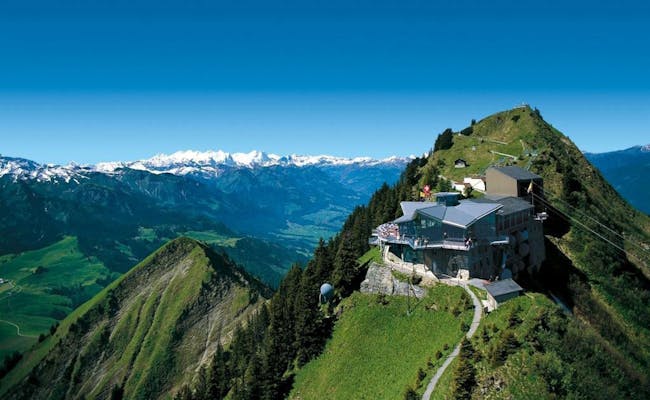 Wandern Stanserhorn Panorama (Foto: Christian Perret My Switzerland)
Roundtrip Trübsee: Trübsee mountain station (1797 m above sea level) - Trübsee - Trübsee mountain station
From Engelberg take the Xpress gondola to Trübsee. The path around the lake is wonderfully suitable for families with small children. In summer, the adventure world Smuggler & Säumer awaits you here with 6 stations around the lake. There are also barbecue areas here.
4 Lakes Hike: Engelberg - Trübsee - Jochpass - Engstlen - Tannalp - Melchsee Frutt - Stöck
The circular route from Engelberg is considered a classic among the high-altitude hikes around Engelberg at the foot of the Titlis. The four lakes on your hike are:
This hike is very popular.
With the ticket of the Engelberg Trübsee mountain railroad, you can use the Xpress gondola lift. this shortens the first section to Trübsee for both hikes.
 Wandern Truebsee (Foto: Engelberg Titlis Tourismus)
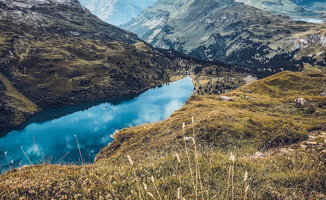 Wandern 4 Seen (Foto Engelberg Titlis Tourismus)
Hiking in the Jura is characterized by vast and dreamy landscapes with large horse pastures. There are fewer surface waters here and many dry valleys only carry water after intensive precipitation.
From Weissenstein via Chamben to Balsthal: Weissenstein - Chamben - Hellchöpfli - Balsthal
The hike leads from the Weissenstein, which you reach by cable car from Oberdorf, first over roads and through the forest. It is very varied, but strenuous. At a difficult rocky spot you will find safety chains. If the path becomes too long at the end, you can shorten it by about 20 min. At the station Thalbrücke - Balsthal you can already catch the train to Oensingen.
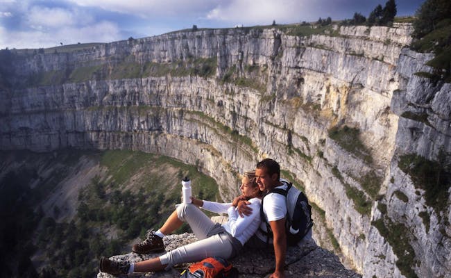
Noiraigue to Creux du Van: Noiraigue (728 m) - Vers-chez-Joly - Ferme Robert - Grand Vy - Ferme du Soliat - Les Oeillons - Noiraigue
This panoramic circular hike starts with a steep ascent.The Creux du Van is a mighty rock. The rock walls drop steeply down about 160 meters. The entire naturally formed semicircular rock massif is 1200 meters wide and 500 meters deep. Noiraigue is accessible by train and post bus.
 Wandern Jura Creux du Van (Foto: Cristof Sonderegger photoplus.ch My Switzerland)
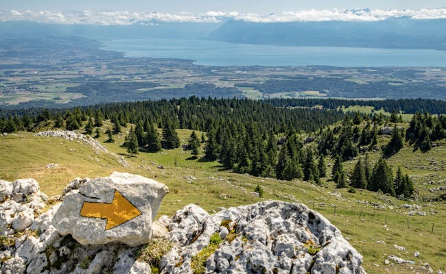 Jura Höhenweg (Foto: Tamara Fehr MySwitzerland
Chasseral Crete: Chasseral Hotel (1,548 m) - Les Coulisses du Haut - Central Square - Les Prés-d'Orvin
You reach the starting point via Biel - St-Imier by post bus. The hiking trail corresponds in large parts to the Jura Höhenweg 5 and runs along nature trails. Already at the hotel you have a unique view over the Dreiseen landscape and the Mittelland up to the Alps. The path climbs gradually and easily to the summit of Chasseral. At the SAC Jurahaus you leave the high trail and hike to the bus stop Les Prés-d'Orvin Bellevue.
A hiking trail network of 3600 km (including the canton of Zug) awaits you in the Zurich region. Are you aware of the diverse and partly spectacular hiking area around the metropolis?
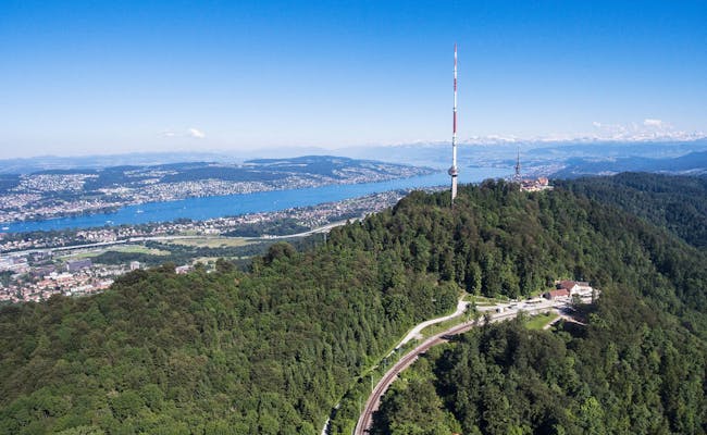
Panorama trail Uetliberg with planet trail Uetliberg (870 m above sea level) - Uto Staffel - Folenweid - Falletsche - Mädikon - Balderen - Felsenegg - Adliswil
Zurich's local mountain can be reached quickly with the S10 from Zurich main station. The Uetlibergbahn takes you up in 20 minutes. At the top you start your hike at the sun of the planetary path. The end is reached at Pluto. Here the mountain station of the cable car Adliswil-Felsenegg LAF is waiting for you. From Adliswil you can take the S4 back to the main station.
Zugerberg Zugerberg(1039 m above sea level) - Wildspitz - Unterägeri
You can reach Zug's local mountain from Zug by funicular in only 8 min. The ascent to the Wildspitz involves some effort. The reward is a uniquely beautiful view of the Schwyz valley basin. Lake Lauerz is clearly visible and from here you can also see Lake Aegeri and Lake Zug in the middle of the alpine world. The end point of the hike is the bus stop in Unterägeri.
With all these options, it's hardly surprising that hiking is the No. 1 national sport in Switzerland. Here you will always find the right hike, no matter where you are.
 Uetliberg Zürich (Foto: Keystone Valeriano di Domenico Zürich Tourismus)
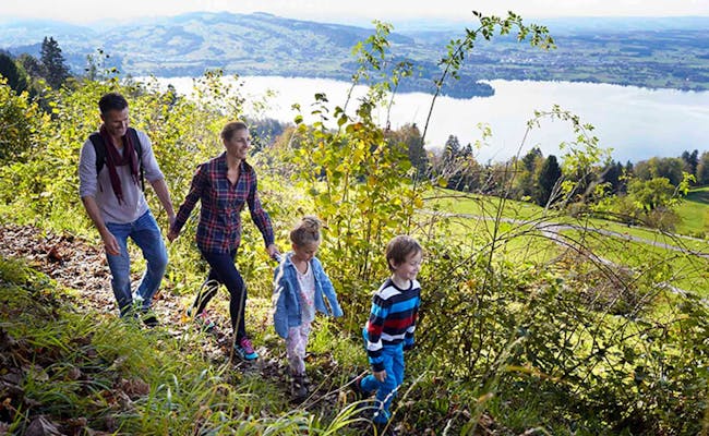 Zugerberg (Foto: MySwitzerland)