TicketLikely to sell out
Ticket funicular Harder Kulm from Interlaken Ost
4.7(1251)All day
FromCHF 9.50
FromCHF 9.50
4 Activities


Ticket
Likely to sell outValidity: All day
booked 22,386 times
Passports
Likely to sell outValidity: All day
booked 36 times

Tour
Duration: 12 hours

Tour
Duration: 12 hours
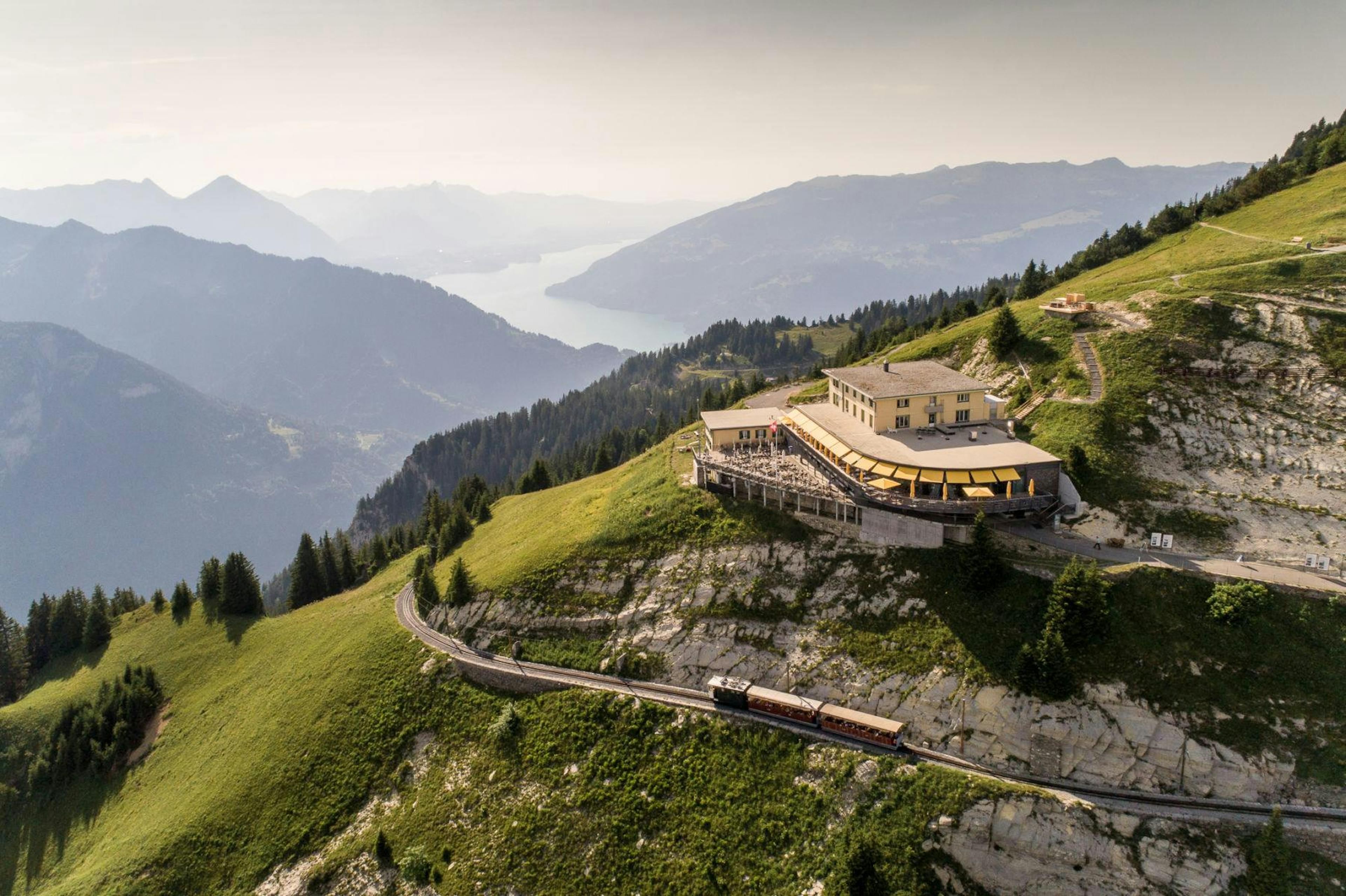
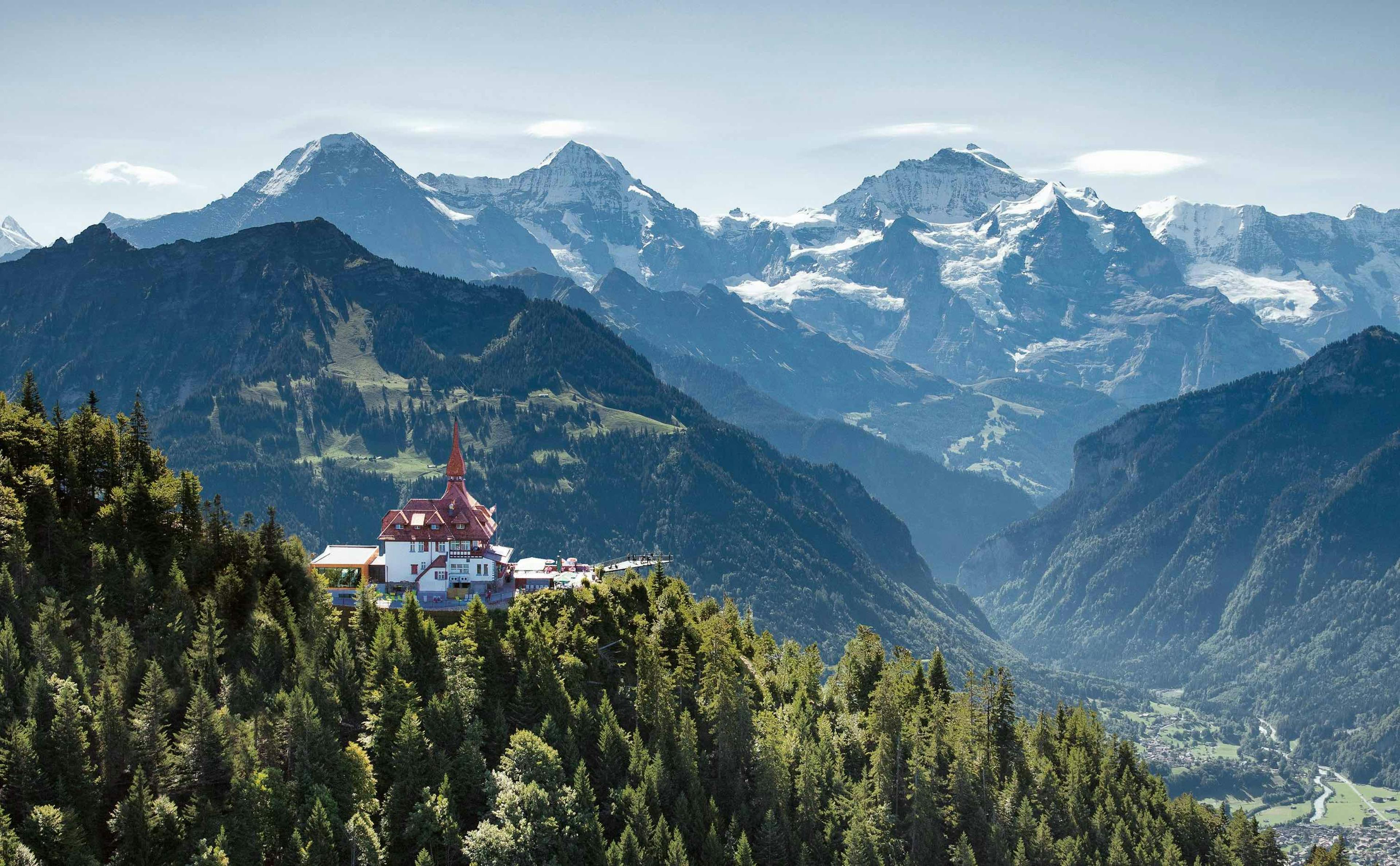
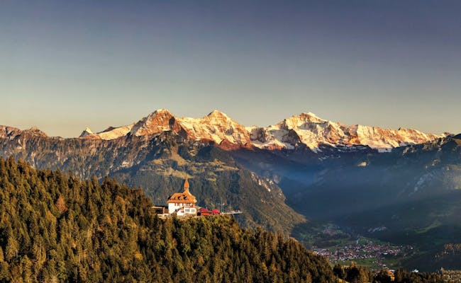
The Harder Kulm is the local mountain of Interlaken in the Bernese Oberland
It belongs to the Emmental Alps and lies at 1322 m above sea level. Between Lake Brienz on the left and Lake Thun on the right, the view extends into the Jungfrau region with the Mönch, Eiger and Jungfrau.
At Harder Kulm you can primarily hike, enjoy the view and barbecue. Many visitors enjoy a meal in the restaurant at the Kulm and combine this with the view from the two-lake footbridge.
 Harder Kulm (Foto: Jungfraubahnen)
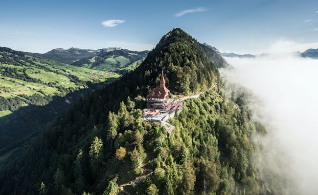 Harder Kulm (Foto: Jungfraubahnen)
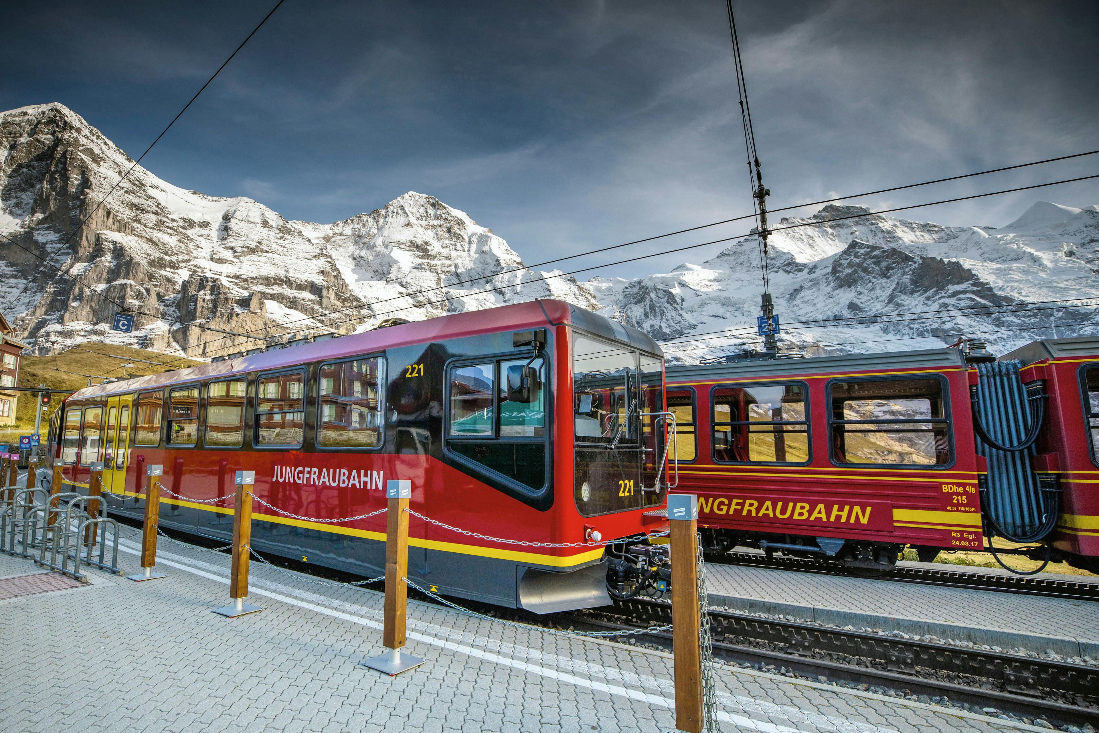
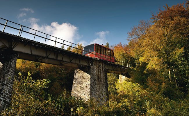
The Harder Kulm is located in the municipal area of Unterseen. The Kulm is reached from the valley station in Interlaken in eight minutes by the Harderbahn. From the Interlaken Ost train station, the Harderbahn station is a ten-minute walk across the Aare River.
The Harderbahn is a standing cable railway, which was inaugurated in 1908. It has the peculiarity that it does not go up in a direct path. It takes a semicircular curve on the mountain and crosses a tunnel.
The Harderbahn runs from mid-April to the end of November.
Data about the train ride:
The railroad operates between April and November. The timetable is not consistent during this time. Between about 8am and about 9pm, the Harderbahn runs every half hour. The night runs are discontinued from the end of October. From this time until the end of November, the train commutes between about 10 am and about 5 pm.
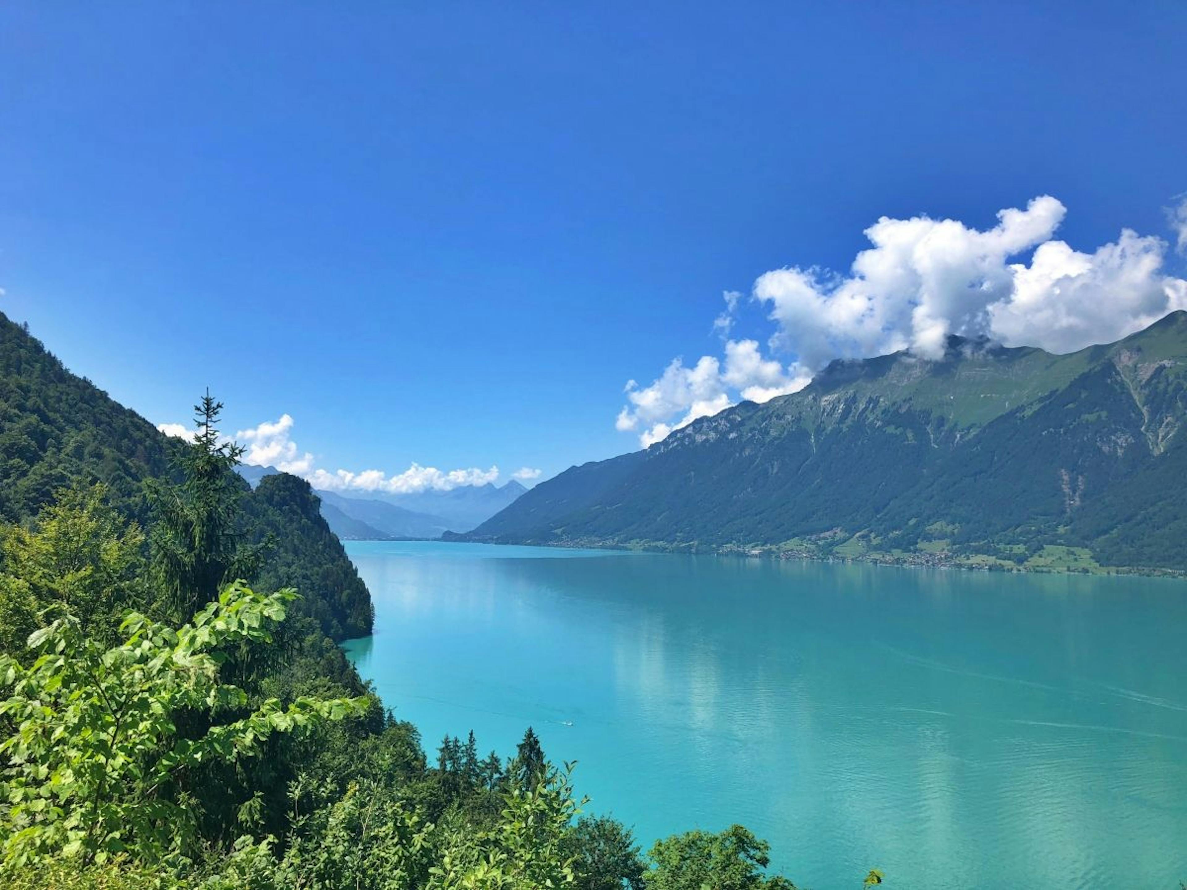
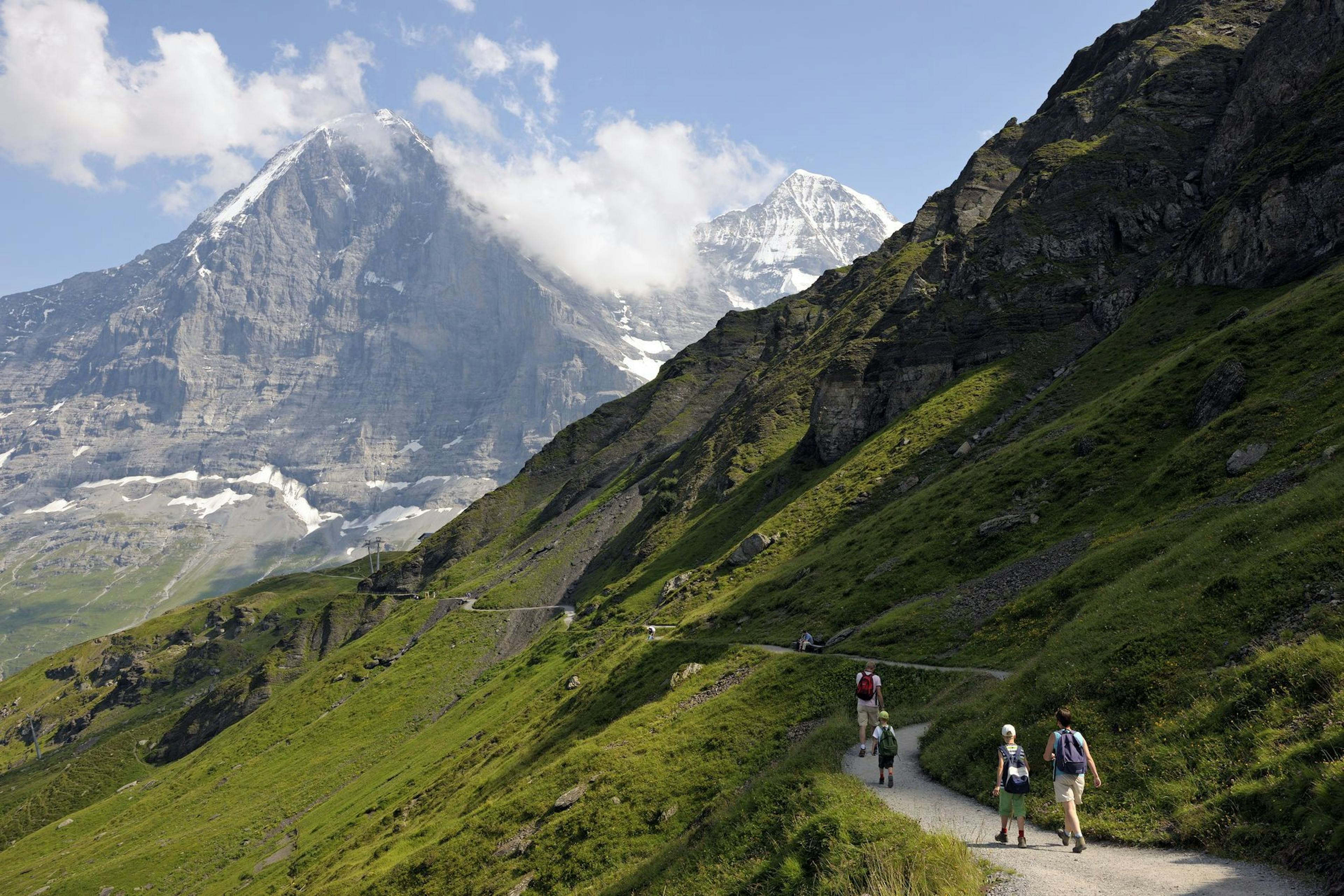
The last time the train's cars were replaced was in 2008. During the ride, the peaks of the four-thousand-meter peaks Eiger, Mönch and Jungfrau can be seen. The deep blue Lake Thun and the turquoise Lake Brienz are also already visible on the uphill journey.
Rides on the Harderbahn can be booked individually as hiking tickets and in combination with the return trip. The mountain railway tickets are personal tickets. They are non-transferable and non-refundable and they are only valid on the selected day. Discounted mountain ride with Swiss Travel Pass/GA.
Swiss Activities offer:
With the Berner Oberland Pass you can travel flexibly on 3 to 10 consecutive days in the Bernese Oberland. It is also valid for the Harderbahn.
 Harderbahn (Foto: Jungfraubahnen)
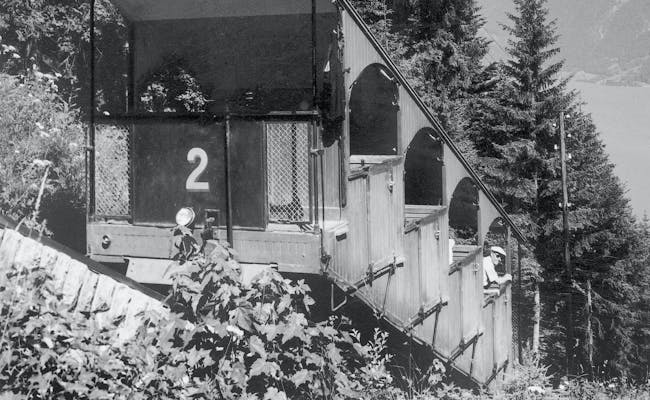 Historische Bahn (Foto: Jungfraubahnen)
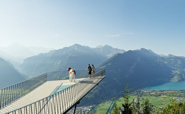
The most popular destination on the Harder Kulm is the viewing platform, also called the Two-Lakes Footbridge. Far below the Kulm, the Hardermannli is recognizable as a face in the middle of the rock.
These excursion destinations can be found on the mountain:
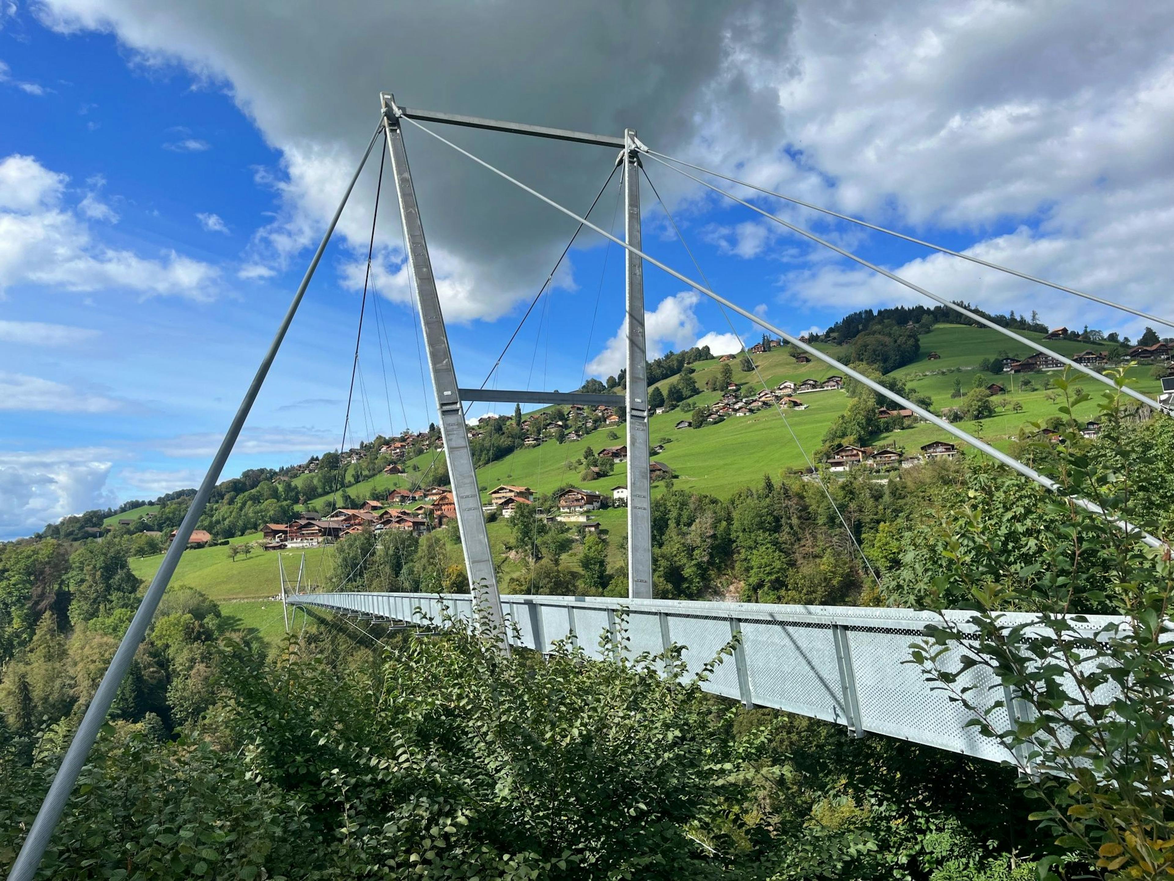
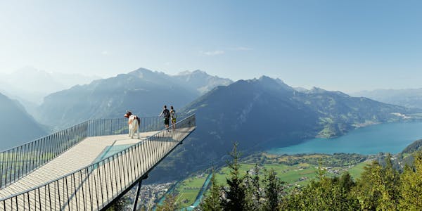
The viewing platform at Harder Kulm is a popular destination and can be reached quickly from Interlaken. The Zwei-Seen-Steg (two-lake footbridge) juts out pointedly in the direction of the mountains and lakes. Its shape makes it suitable for photographing in three directions.
 Aussichtsplattform Zwei-Seen-Steg (Foto: Jungfraubahnen)
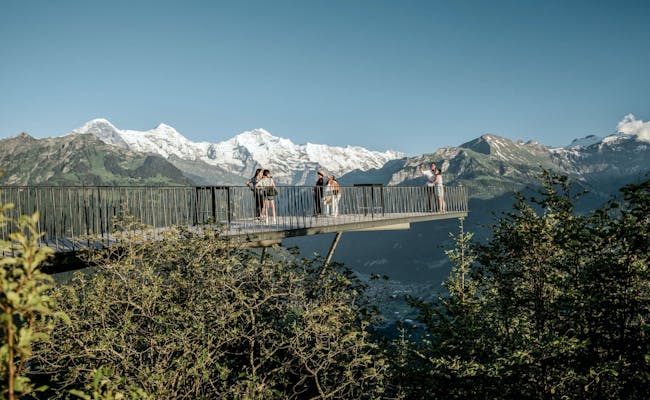 Aussichtsplattform Zwei-Seen-Steg (Foto: Jungfraubahnen)
Lake Brienz is on the left, the view goes to Giessbach with the waterfalls in the west behind the lake. To the east, Iseltwald and the area up to the Schynigen Platte are visible. Further in the background the mountains Roteflue (2296 m a.s.l.) and Loucherhorn (2230 m a.s.l.) are visible, behind them the higher mountains Wildgärst (2891 m a.s.l.), Schwarzhorn (2928 m a.s.l.), Faulhorn (2681 m a.s.l.) and Reeti (2757 m a.s.l.).
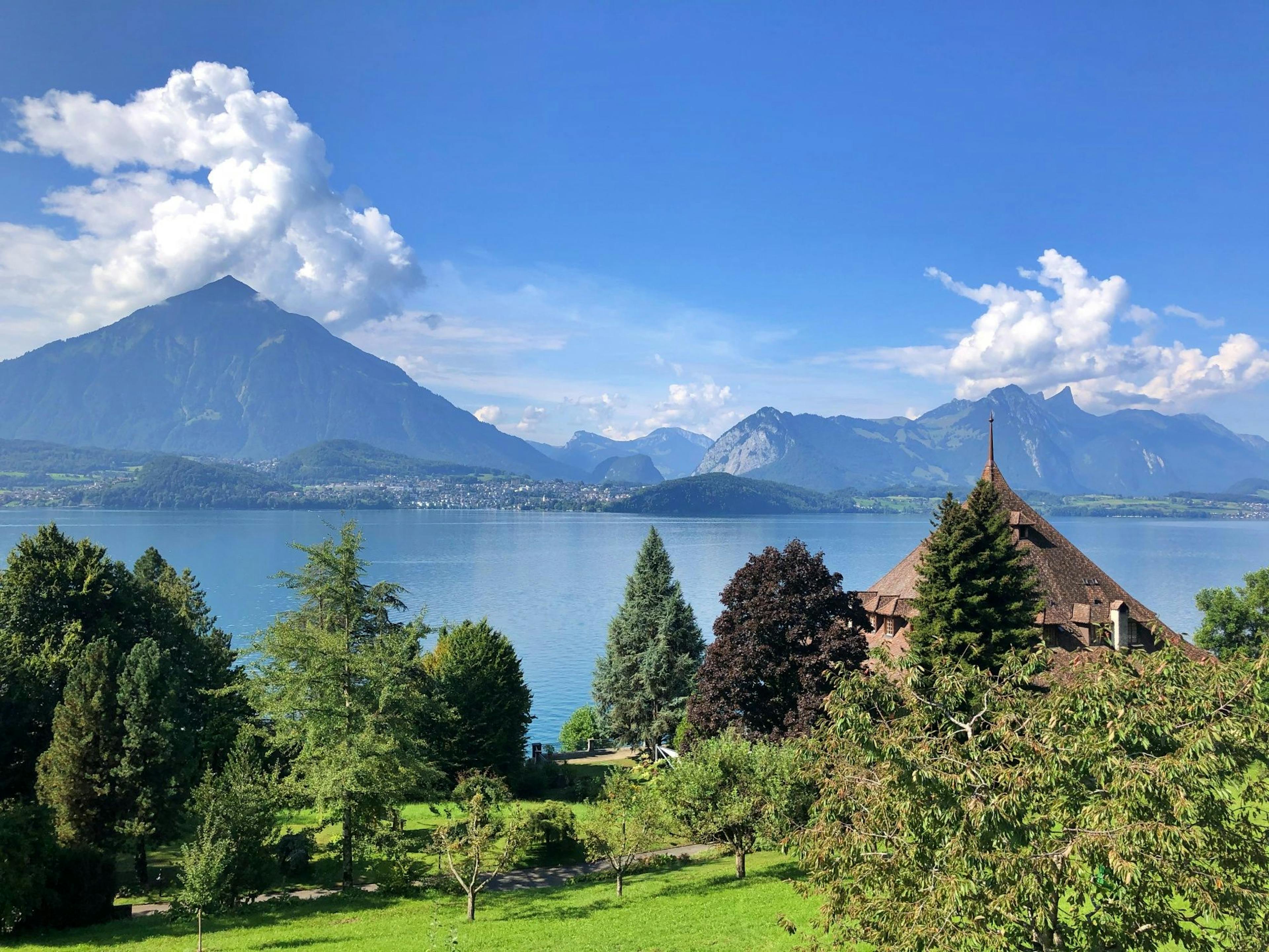
Lake Thun can be seen on the right, the mountains Niesen (2362 m a.s.l.) and Drunengalm (2408 m a.s.l.) are well visible behind. From the viewing platform, the excursion boats can be observed sailing across the two lakes.
Interlaken with the Höhematte and the river Aare lies between the two lakes and the mountain range of the four-thousanders is visible in the background. The Eiger, Jungfrau and Mönch are clearly visible as a trio from the viewing platform, which towers far above the annex. A glass panel has been incorporated into the floor of the platform, providing a downward view of a dense forest. The dense forest, fields and meadows can be seen above the triangular cutout.
The Hardermannli is a rock face in the Harder, the local mountain of Interlaken. It is located in the middle of the Harder forest and below the Falkenfluh lookout point. There are various myths and traditions about this face with its nose, eyes, mouth and moustache.
The monk is said to have stalked a young girl on the Harder who threw herself down the mountain out of sheer desperation. The punishment of God was that the monk now had to look down on this place of his crime for eternity.
Leonhardus, who was called Harder, is said to have been a cruel man, intent on his own advantage. He fell in love with a fisherman's daughter and wanted to make her his slave. When she became pregnant, she swallowed poison and confessed to her father. The furious father is said to have split the Harder's skull with a hatchet. At the same moment there were thunder and lightning and stones fell from the mountain. Afterwards the face of the Harder became visible in the rock. For the people of Bödelis it serves as a memorial of the abbot's shameful deeds.
He is said to have been unkind to the forest dwellers, especially the dwarves. When he was asleep, the dwarves would have risen and cut off his head. As a sign of their victory, they would have hung it up in the rock.
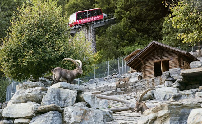
A visit to the Alpine Game Park can be combined with a hike or train ride to or from Harder Kulm. It is located about 200 meters from the valley station of the Harder cable car and is reached via the slightly ascending path to the left of the cable car station.
The game park features several enclosures with ibex, which are now common again in the region (especially on the Augstmatthorn). The ibex was already extinct in Switzerland in the 19th century and was bred and reintroduced in the Alpine Game Park, which opened in 1914. The enclosures are equipped with massive wooden houses and large cairns and stone slabs, the paths are paved and clean.
A marmot colony also resides in the wildlife park. The Alpine Wildlife Park is open daily and free of charge. Admission is free, donations are gladly accepted.
The Hohbüel Pavilion lookout point is located a few meters above. Next to the pavilion is a barbecue area that can be used by hikers. About 50 meters further in the forest is a second barbecue area, which is additionally equipped with wooden benches. The view from both barbecue sites goes over the Bödeli between Lake Brienz and Lake Thun.
 Steinbock Wildpark (Foto: Jungfraubahnen)
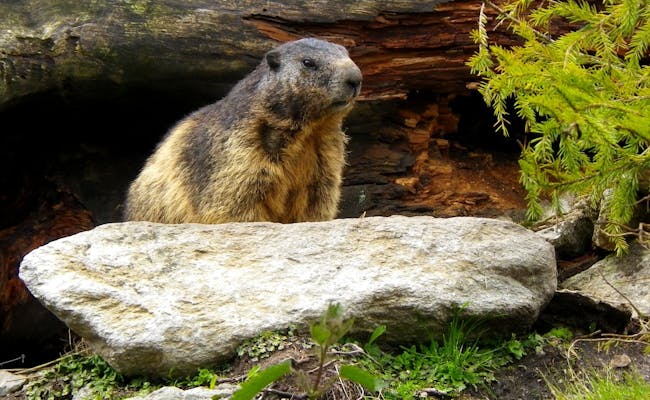 Murmeltier (Foto: Seraina Zellweger)
The season at Harder Kulm is from mid-April to the end of November. Outside this time the Harder Kulmbahn does not run.
The most popular activities in summer are hikes.
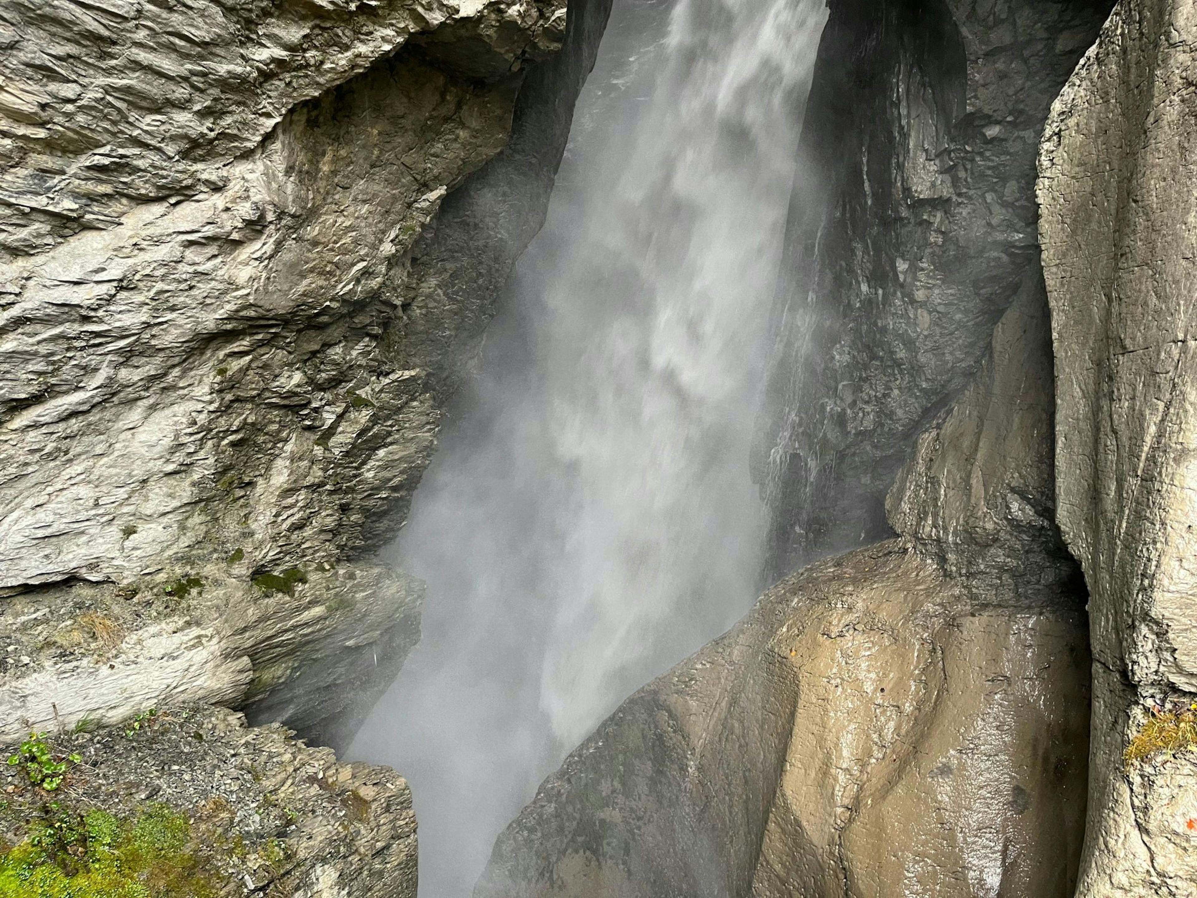
Safety at Harder Kulm: The rock of the mountain is "overturned". This means that the younger layers of the rock are above the older layers. They are mainly chalk sediments, which are prone to strong rockfalls. Especially in times of snowmelt or after long rains, caution is advised. Rockfall nets, raised protective dams and an early warning service ensure safety.
As a hiking destination, the Harder Kulm can be reached from Interlaken in two and a half hours, and after a refreshment with a view, a comfortable return trip on the Harderbahn is assured. Conversely, you can also take the train up and walk down. The hike is thus shortened to two hours and is very easy to manage, as it only goes downhill. Shortly before the valley station, a detour to the Alpine Game Park can be planned.
Hikes from Kulm to surrounding destinations or over the Harder Grat are possible from April to October. The panorama restaurant at the Harder Kulm is always open during this time when the operating hours of the Harderbahn apply.
Hikes to excursion destinations that start from the Harder Kulm either begin with the ride up (also to save energy) or include the hike to the Kulm.
The Harder Kulm, which belongs to the Emmental Alps, lies at an altitude of 1,321 meters. A hike of medium difficulty brings visitors to the Harder Kulm in about 2.5 hours on foot. The trail leads from the Interlaken Ost train station along the Aare river first to the valley station of the Harder cable car. From here, the path goes up in quite a few hairpin bends, some of which are very steep. Through the Bleiki forest, the Falkenfluh is reached first.
The Falkenfluh is a vantage point above the brow of the Hardermannli. Below the railing, the rock drops directly down vertically, giving a view of Interlaken and the chain of four-thousand-meter peaks with the Eiger, Jungfrau and Mönch to the south. Between Lake Brienz and Lake Thun lies the Bödeli.
The further mountain path is well developed and allows a pleasant ascent over a wide mountain meadow. Here the view reaches over Lake Thun to the mountain Niesen. Past the panorama terrace of the mountain restaurant, the wide path leads to the mountain station of the Harder cable car.
The path is signposted and should not be left for safety reasons. The hiking ticket of the Harderkulmbahn allows the trip down at a reduced price.
A moderately difficult hiking trail leads from Interlaken Ost via Pavillon Hohbüel to Harder Kulm.
The trail starts to the left of the valley station of the Harder cable car and leads up over some serpentines. On a small road the path continues to the pavilion Hohbüel at the end of the road. The pavilion Hohbüel is a viewing platform. The path continues in the opposite direction.
It rises gradually and leads along the slope in the direction of Goldswil. After about two hundred meters the Harder cable car crosses the trail and shortly after that the natural road. Shortly before Goldswil, it continues from a clearing on a paved road to Goldswil.
With a view of the Burgseewli on the right, the trail turns left off the road into the forest. Now it runs back in the opposite direction, goes after the larch grove "Obere Bleiki" diagonally upwards and again under the railroad.
The resting place at 1113 m above sea level above the Hardermannli is reached. It is now about twenty minutes' walk to the mountain restaurant.
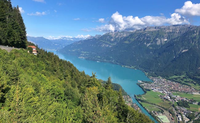 Brienzersee (Foto: Seraina Zellweger)
 Brienzersee (Foto: Seraina Zellweger)
There are several circular trails on the Harder Kulm that are easy to master. Prerequisite are mountain boots with a grippy sole. Mountain sticks make the hike easier.
An official circular trail starts at 1,321 meters above sea level at the panorama restaurant. It starts as a wide and stony mountain path with an incline up to the Hardergrat. The view extends from Lake Brienz over the Bödeli between the lakes to Lake Thun. The summit group of Eiger, Mönch and Jungfrau is clearly visible.
The descent is leisurely on a narrow path to the Wanniwald and on the further path to the Elfenweg. Afterwards it goes back to the Harder Kulm. On the way, the circular trail informs about curious incidents and eerie occurrences along the way. The tour is open between April and October. It is listed in the Jungfrau Railways panorama map as Hike 76.
Another circular trail of about 2.3 kilometers in length leads through the Luegi Forest to a vantage point at 1,437 meters above sea level. The trail starts between the mountain station of the Harder cable car and the restaurant. It takes about one hour and 40 minutes and overcomes 182 hm of ascent.
This demanding tour starts at the Harder Kulm at the top station of the Harder cable car heading northeast. For inexperienced mountain hikers, a guided hike is recommended. The trail leads through the coniferous forest and climbs steadily. At an alpine meadow, the view of Interlaken and the two lakes against the mountain backdrop is possible.
The further trekking tour over the Hardergrat continues through the forest and then over the ridge, which is pleasant to walk at first. A steep ascent goes towards the 2,085 meter high mountain Suggiture. The path over the ridge is very steep in parts and it is possible to go up here on the hiking trail of the northern grassy flank.
Once further up, an impressive view of Lake Brienz and the entire mountain world is possible. The next destination is the 2,137 m high Augstmatthorn mountain. Ibex can often be seen on this route. The descent is to the northwest to Lombachalp.
This demanding tour starts at the Harder Kulm at the top station of the Harder cable car heading northeast. For inexperienced mountain hikers, a guided hike is recommended. The trail leads through the coniferous forest and climbs steadily. At an alpine meadow, the view of Interlaken and the two lakes against the mountain backdrop is possible.
The further trekking tour over the Hardergrat continues through the forest and then over the ridge, which is pleasant to walk at first. A steep ascent goes towards the 2,085 meter high mountain Suggiture. The path over the ridge is very steep in parts and it is possible to go up here on the hiking trail of the northern grassy flank.
Once further up, an impressive view of Lake Brienz and the entire mountain world is possible. The next destination is the 2137 m high Augstmatthorn mountain. Ibex can often be seen on this route. The descent is to the northwest to Lombachalp.
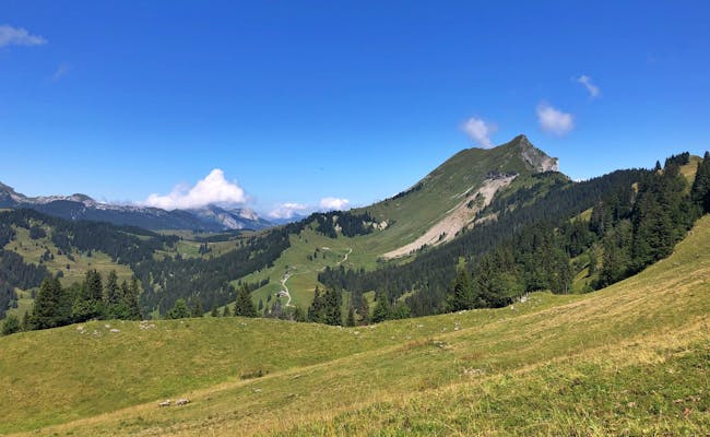 Wanderung Augstmatthorn (Foto: Seraina Zellweger)
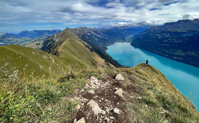 Wanderung Augstmatthorn (Foto: Seraina Zellweger)
At the Harder Kulm there are regular culinary offers. Events are organized irregularly. These include, for example, folklore evenings with alphorn blowers and accordion on the two-lake footbridge. Three function rooms in the restaurant can be used for family or company celebrations.
From 07.06. to 18.07.2021, the restaurant will offer the Harder Kulm by night. Late descents of the mountain railroad (until 21:40) favor a long evening experience at the Kulm.
In addition to the ascent and descent, aperitif and dinner (excl. drinks) are included in the panorama restaurant Harder Kulm. The ascent is possible with the combination ticket at 17:40 at the earliest.
In the period from 07.06. to 28.11.2021, Kombitickets can be used for lunch on the Kulm. Included are also the ascent and descent as well as the menu of the day 1 incl. soup of the day (without drinks).
In the period from June to October 2021, a Sunntig-Zmorge will be offered in the restaurant. For this, the first lifts leave already at 08:10 am. Last ascent for breakfast is at 10:10 am. The breakfast buffet is open from 8:30 to 11:00.
 Restaurant Abend (Foto: Jungfraubahnen)
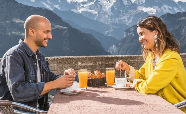 Restaurant Terrasse (Foto: Jungfraubahnen)
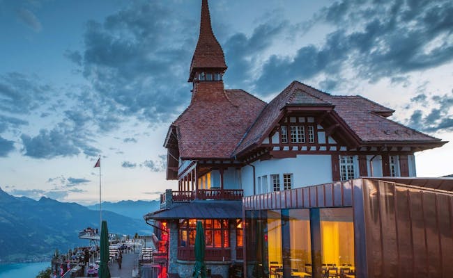
The panorama restaurant on the Harder Kulm has a red tiled roof and a matching pointed turret.
The restaurant has a large sun terrace that offers a similar view to the viewing platform.
The restaurant has:
The new building is equipped with presentation technology and can be rented exclusively.
The restaurant can be reached via the Harderbahn, on foot or by car. The restaurant is open during railroad operating hours.
The warm cuisine consists mainly of Swiss and Italian dishes. An attraction is the 650 g cordon bleu offered in the restaurant. Burger and children's menus are also available.
Groups of 15 or more receive meals by advance order. Group menus and group delight menus are available in separate menus.
The Harder Kulm reaches 1322 m above sea level and, seen over the year, hardly differs from the climate in Interlaken. The pleasant temperatures start with the decrease of cloud density in April/May and end around October. This is also the period in which the Harderbahn and the restaurant at Kulm are open.
In summer the warmest temperatures reach about 24°C, the coolest are 14°C at night. The nights here get very cold (0-7°C) from December to mid-February. In January and February you have to expect high probability of precipitation, in summer it is rather low.
The Harder Kulm is located above Interlaken. Interlaken is located in the mountainous Bernese Oberland in central Switzerland and is easily accessible from all directions by train and car.
By car, it takes about an hour to reach Interlaken from Lucerne via the A8 freeway. From Geneva, the shortest journey via the A1 freeway takes about 2.5 hours. From Bern, the route via the A6 freeway takes about fifty minutes to Interlaken.