
Rent
Boat hire for Aareböötle from Thun to Bern
Duration: 6 hours
FromCHF 160
FromCHF 160
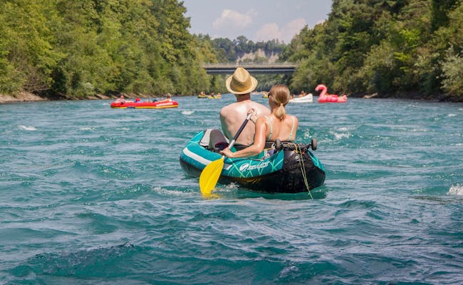
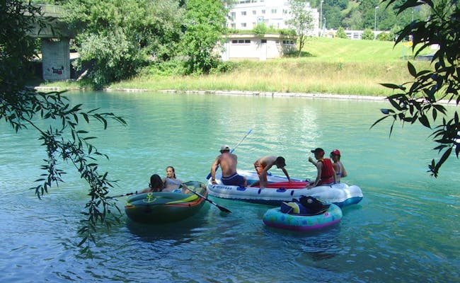
Böötle is a particularly popular summer activity for families and friends. Böötle is the Swiss German word for floating down Swiss rivers in an inflatable boat, air mattress, inflatable boat or even a floating tire.
What do you do at Böötle? With the Böötle you get in with your floating vehicle at one point of the river and let yourself float. You can get off at any point and take the train or bus back to the starting point. Don't forget your waterproof bag with water, dry clothes, shoes and other things you need for the return.
This is very popular in Zurich, for example, where many friends, families, and couples float down the Limmat River in a small inflatable boat, a pink flamingo, or a floaty tire in the summer.
You are spoiled for choice when it comes to choosing the right route and the right river. At the bottom of the page you will find important information about equipment, safety and specific dangers when boating in the FAQ. Above all, it is important to start the exit in good time before danger spots, power stations and weirs.
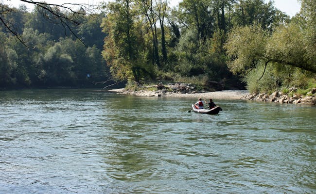
 Aareböötle Bootsfahrt (Foto: Outdoor Interlaken)
 Aareböötle vor Bern (Foto: Seraina Zellweger)
When choosing the right route and the right river, you are spoiled for choice. We have compiled important information about equipment, safety and specific dangers when Böötle in the FAQ at the bottom. Above all, it is important to start the exit in time before danger spots, power plants and weirs.
There are several popular river tours in Switzerland. Here are first the 10 most beautiful Böötle tours briefly summarized:
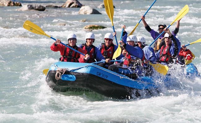
Aare: Thun to Bern (3-4 hrs): This is the best known and most popular Aare rafting route, leading from Thun Schwäbis via the legendary Uttigen rapids to Bern. This route can also be shortened (Uttigen-Camping Eichholz)
Ticino (Ticino): Cresciano to Arbedo (1.5 to 2 hours): the river, still wild at the beginning, passes wooded slopes and gravel banks, plus the view of the Ticino Alps
Reuss: Bremgarten to Gebenstorf/Windisch (4 hrs.): a scenic stretch, but requires a lot of attention due to rapids and rocks as well as a weir behind Bremgarten; it can be shortened in Mellingen.
Rhine: Stein am Rhein to Schaffhausen (3.5 to 4.5 hrs.): along forests, weaving mountains and romantic villages, the route is leisurely to Schaffhausen with the gigantic Rhine Falls.
Linth: Being to Schmerikon (3 to 4 hours): The tour connects the Walensee with the Obersee.
Limmat: Zurich to Dietikon (2 to 2.5 hours): the route is much traveled and can for safety's sake also be started after the Höngger weir.
Saane/Aare: Gümmenen to Aarberg (3-4 hours): The trip leads from the Saane into the Aare, in parts it goes through a nature reserve (bathing is prohibited there)
Reuss: Sins to Rottenschwil (3-4 hrs.): the route on the Upper Reuss can already be started from Gisikon, the ride has hardly any dangerous spots
Rhine: Neuhausen am Rheinfall to Rheinau (3-4 hours): The impressive Rhine Falls can be admired at the beginning of a romantic tour to Rheinau Monastery.
Rhone: Geneva, Pont Sous-Terre - Geneva, Le Lignon (2-3 hours): The Böötle takes you through largely unknown parts of the Geneva region with beautiful bridges
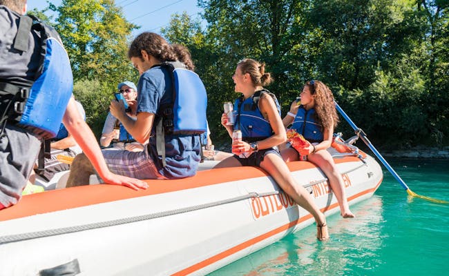
Not everyone wants to buy their own rubber boat right away to pursue this recreational sport. A good alternative are boat rentals, which often even bring and fetch the boats. And for people who don't want to take care of anything themselves, there are guided Böötle.
The organizers have safety certification and public liability insurance. They offer certain routes, guide the rubber boats and watch out for obstacles and dangers. Both boat rentals and providers of guided tours are listed below for each river.
Guided tours are available between May and the end of October, depending on weather conditions.
 Aareböötle Bootsfahrt (Foto: Outdoor Interlaken)
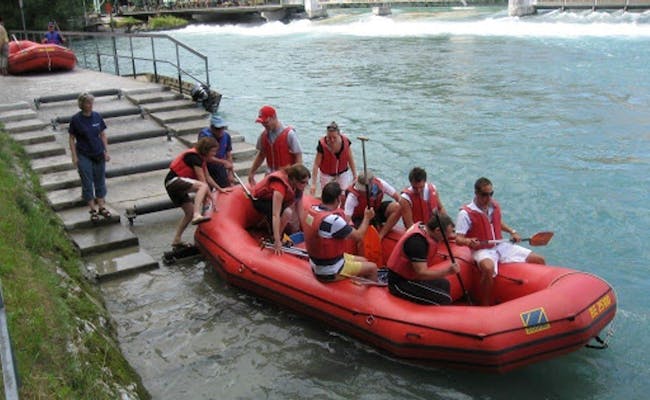 Aareböötle Bootsfahrt (Foto: Marina Travel)
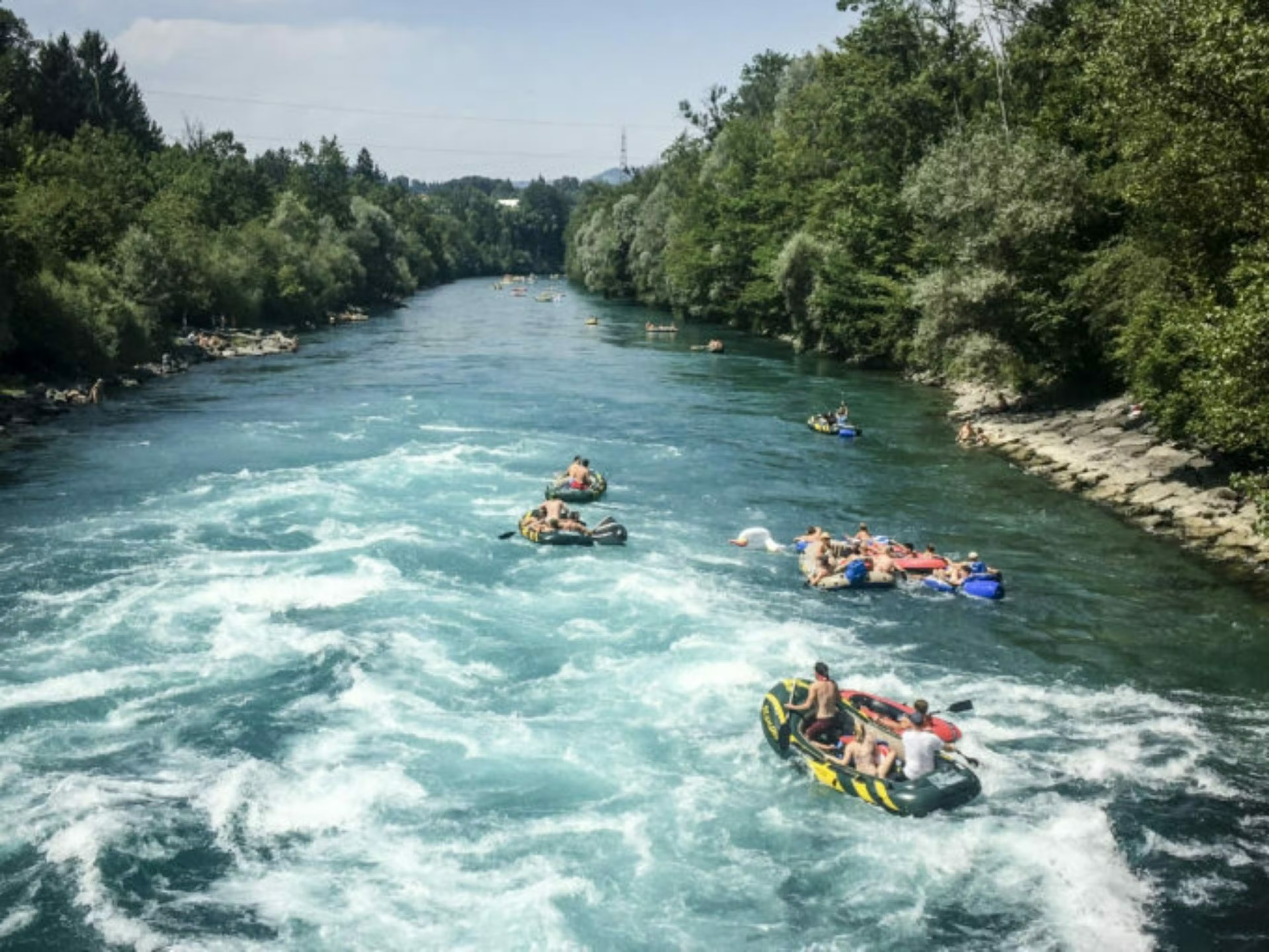
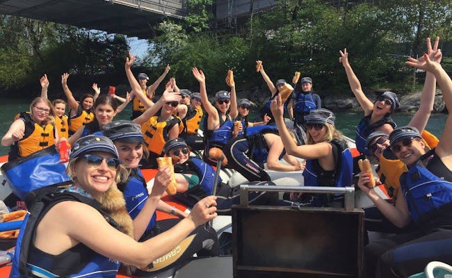
On the 27 km long stretch between Thun and Bern, a lot of rubber boats cavort to the Böötle in summer. This is no wonder, as this section is one of the most popular in Switzerland. In 2011, there were 598 boats with 1214 participants. This was the world record and an entry in the Guinness Book.
But also on the Kallnach- and Hagneckkanal you may drift with your rubber dinghy, it contains no danger spots.
You can also use the stretch between Schwellenmätteli and the weir Felsenau for a Böötle, this stretch is pleasantly quiet.
Between Wohlensee and Aargau there is a Böötle route that is considered a sporty alternative. This route is more of a rafting route and not for the lazy. You have to paddle together at full speed to make progress, as the Aare flows very slowly here.
You can find another eight suitable stages for a Böötle on the altogether 288 km long Aare between Biel (Nidau) and Full/Reuenthal:
Water level Aare: The recommended discharge in Brügg is: <400 m3/s.
 Aareböötle Bootsfahrt (Foto: Outdoor Interlaken).
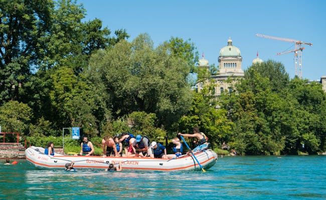 Aareböötle Bootsfahrt (Foto: Outdoor Interlaken).
You should pay attention to the usual entry points for the Böötle. They are particularly suitable and have proven themselves.
The entry point in Thun is at Allmund-Schwäbis on the right-hand side of the river, behind the Regiebrücke bridge by the Bellevue restaurant. Schwäbis railroad station (Steffisburg) is right next to it.
There is another entry point in Uttigen after the railroad bridge on the left (5 minutes from the station).
In Bern the boarding point is in Schlipf at Schwellenmätteli, Dalmaziquai 11, right next to the Schwellenmätteli restaurants (5 min from the station).
In Worblaufen you will find the entry point 100 m after the Tiefenaubrücken bridges on the right (5 min from the station).
In Wohlensee you can generally get in anywhere. One possibility is the Wohleibrücke bridge, which is very suitable for boarding.
In Nidau am Bielersee you will find the entry point for Biel below the lock. The parking lot and WC are close by. The next entry point is near the Altreu information center at the bend in the river.
In Wangen a.A. you get in next to the Städtli bridge.
In Aarwangen at the Schlipf in front of the pontoon clubhouse, you can get in from the left before the castle
In Murgenthal at the steps in front of the Aare bridge from the right.
 Aareböötle Bootsfahrt - (Foto: Outdoor Interlaken)
 Aareböötle (Foto: aarelauf.ch)
About five kilometers after the start in Thun, you reach the railroad bridge at Uttigen with the infamous Uttigen wave. Here you have to distribute the weights in the boat evenly and approach the wave in the middle.
Course ships and occasional ships you must regularly avoid and at ferry points a central driving is announced.
At Münsingen dead wood and shallows have to be taken into account.
For a stretch "around Bern", the Stauwehr Engehalde must be bypassed.
At Büsen, navigation of the Aare side arm "Häftli " is not permitted from spring to autumn.
Between Wangen a.A. and Murgenthal you will pass through two nature reserves where it is forbidden to enter or leave the water. Before the power station Wynau, the Aarestau Wynau and the old gravel pit Schwarzhäusern are such an area. You are allowed to drive through, but you have to keep a distance of ten meters to the shore. The same applies to the "Vogelraupfi" between Berken and Bannwil. You must drive around the island at a distance of at least 50 meters to the south.
After Wangen there are more and more hydroelectric power stations and before the respective weirs you absolutely have to ditch. Shortly before Aarwangen you reach the Bannwill power station (bypass on the left bank), after Aarwangen the Wynau/Schwarzhäusern power station (also bypass on the left bank), after Wolfwil comes the Aare-Cheer. You have to watch out for the waves! After Solothurn you reach the next power station: Ruppoldingen. Here you have to go around to the right.
Further danger spots are those of the Kehrwasser Aare-Waage near Aarburg and the Felsens Chessiloch before the wooden bridge Olten. The Aare is forced to make a sudden left turn at Aarburg by a rock spur. This creates a large sweeping water - called "Woog". The water flows back through the vortex. It is best to go around the Woog on the left side.
After Olten you drive between Trimbach and Winznau into the Kraftwerkskanal (power station Olten-Gösgen). Because of a current towards the weir, you have to drive entirely left along the bank.
The weir in Aarau (Rüchlig power station) must be approached carefully. The disembarkation requires special care. It is best to go right, because of the current towards the weir. Several boats should land one after the other.
In Brugg the rubber boat has to be carried for about 1,200 meters. For safety reasons, the deep and wild gorge should not be navigated.
The estuary of the Aare-Reuss-Limmat is called Water Castle. All islands belonging to it may not be entered
At the Klingnau Reservoir there is a protected area of international importance for waterfowl and migratory birds. You have to drive around all nature protection zones with a distance of 50 m and you have to follow the given access to the disembarkation point. In general, you are allowed to pass through the protected area, but not to stop or land.
 Aareböötle Ausrüstung (Foto: aarelauf.ch)
 Aareböötle Jaberg Felsblock Bauernhof (Foto: aarelauf.ch)
The following exit points have been tried and tested and should be adhered to for safety reasons.
The following boat rental companies rent boats for Aare-Böötle:
 Aareböötle Bootsfahrt - (Foto: Outdoor Interlaken)
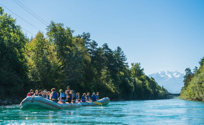 Aareböötle Bootsfahrt - (Foto: Outdoor Interlaken)
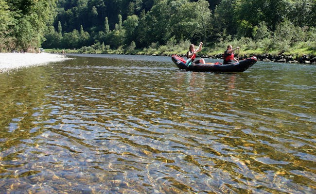
The most popular route for Limmat-Böötle is the one between Zurich and Dietikon. It is well connected to public transport and is always well frequented due to its proximity to the big city. The interesting mix of urbanity and beautiful nature offers a high recreational value.
The Limmat is very busy on the 10 km between Zurich and Dietikon, but you can also get on at the Höngg weir and save yourself the trouble of changing boats at the weir. The sections of the river bank that have been made natural by beavers begin after the Werdinsel behind the weir. The further stretch beyond Baden ends at Kappelerhof at the latest.
A popular boarding point is on the right side of the stairs of Wipkingerpark in Zurich. It can be reached directly by streetcar on line 13.
Bus and streetcar access. Directly after the Höngger Weir there is another boarding point. It is the place that is also reached on the left side after transferring the boats.
The Höngg weir is very dangerous. Time and again, people who have missed the exit have accidents here. The exit point before the Höngger Weir is on the left side.
You pass the Mühli weir on the left. The weir to Kraftwerk Aue must also be bypassed and you must disembark at the latest before the weir at Kraftwerk Kapellerhof.
On the stretch between Wipkingerpark and the Höngg weir (lower Limmat), according to the safety information of the city of Zurich, the Limmat should not be navigated by rubber dinghy when the discharge exceeds 100 m3/s.
The exit points before the Weir Höngg are signalized on the left bank. You can disembark at the concrete ramp. You have to carry the boats 60 meters on foot.
The Allmend Glanzenberg is a good place to get out of the boat, because you have a lot of space, toilets and direct access to the S-Bahn station Glanzenberg.
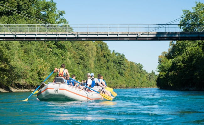
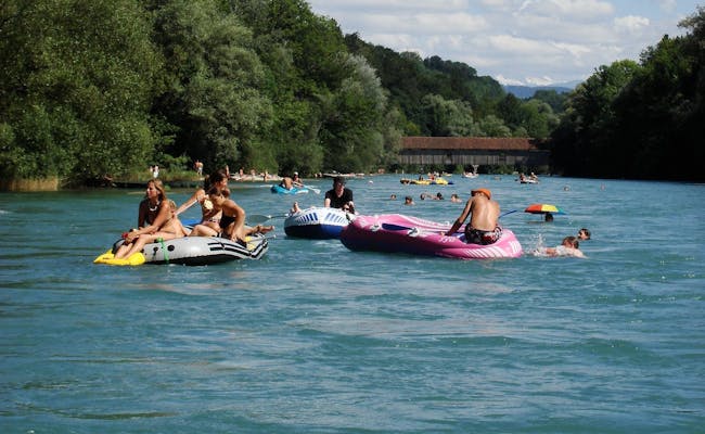
 Aareböötle Heimberg Uetendorf (Foto: aarelauf.ch)
 Limmat Böötle (Foto: Seraina Zellweger)
For river tours with a rubber boat, the slightly curved Reuss is a popular choice. The Reuss is a natural watercourse in many places. It offers much tranquility, but also has adventurous passages.
On the way you will pass some interesting bridges like the beautiful wooden toll bridge at Sins. Artificial obstacles and some weirs you have to watch out for, otherwise you can easily explore the Reuss by rubber dinghy. Besides calm stretches, it also has sections with a strong current.
Especially the Lower Reuss requires your full attention. You should always pay attention to warning signals and clarify possible entry and exit points in advance. Almost on all stretches there are possibilities for an early exit.
The section between Bremgarten and Gebenstorf is a popular Böötle route on the Reuss. It is 24 km long and belongs to the Lower Reuss. There are two other stretches on the Upper Reuss between Sins and Rottenschwil and Gisikon and Rottenschwil.
The Reuss is the fourth largest river in Switzerland. Since it is a glacial river, there are often higher water levels in June and July, especially after additional rainfall. Therefore, navigating the river with a rubber boat is not without danger in these weather conditions.
The Untere Reuss is one of the most beautiful stretches of river.
It is at the intersection of Reussgasse and Augraben near the Hexenturm. Here you can conveniently leave your boats on the river bank while you bring your car to the parking lot at the city wall. Here you have to pay parking fees, but you are only allowed to park for a maximum of 5 hours.
Honeggerwehr to Bremgarten: about 1.5 km after the start in Bremgarten you come to an island in the river. In the left arm of the river you go through a surf wave that extends over the whole arm of the river and is only used by whitewater paddlers. So you take the right arm of the river. There is a bigger surge here that needs to be watched out for. You need experience for this.
The river moves in curves through wooded areas with little development. Larger boulders, dead wood, but also a few rapids and rollers in the riverbed will meet you on the way. They can be avoided very well if you drive attentively and with foresight. In Gnadenthal there is a fall in the riverbed, which you better bypass far to the right. There are also ** rapids** in the water at Gnadenthal.
If you want to continue beyond Gebenstorf, you will have to go out of the water and get back in after the weir.
Next to the sunbathing lawn the boats may be loaded. However, parking is not allowed here or in the residential area. You reach the boat landing stage via road 3, the connecting road from Gebenstorf to Windisch. Before the bridge, turn right into Birmenstorfer Strasse and continue along Badstrasse to the end, where the sunbathing lawn is located.
The Upper Reuss encounters the towns of Gisikon, Sins to Rottenschwil.
There are no particular danger spots on the route. In Ottenbach at the prank weir you should keep to the left. However, special caution is required as soon as course ships approach.
The most popular exit point is Rottenschwil, before the Reuss bridge on the left. Both parking lot and bus stop Rottenschwil/Hecht are directly at the exit. But before that you can also get off at Ottenbach. You have to get off at the Bremgarten power plant at the latest because of the barrage.
 Reuss
Reuss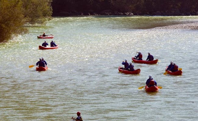 mehrere Schlauchboote Swissraft (Foto: Swissraft Tessiner Tourismusagentur ATT SA)
Aargauerwasser is a tour operator in Untersiggenthal.
Highlights:
The trip from Bremgarten to Wasserschloss starts at the Witch Tower in Bremgarten and ends in Gebenstorf Rüssbädli or at the mouth of the Limmat in Stroppel, Untersiggenthal. It leads along the only unobstructed and undammed section of the river in the Swiss midlands.
You also get on at the Hexenturm for the ride through the meadows and loops of the Reus. The scenic ride ends in Gnadenthal. The city-to-city tour starts again at the Hexenturm and ends in Mellingen at the old people's home or at the ARA.
The ride from the terminal moraine to the moated castle starts in Mellingen at the old people's home or at the sewage treatment plant. It ends in Untersiggenthal at the mouth of the Limmat in the Stroppel. At the Birmenstorf-Mülligen bridge, the journey from the lower reaches begins and ends at the moated castle in Untersiggenthal at the mouth of the Limmat in the Stroppel.
Extras: Lunch at the restaurant on the river (Mellingen) for a full-day tour, barbecue or picnic from the backpack; shore excursion to renaturalized floodplain areas under expert guidance
Included: Boat guide, equipment
Garnhaus in Untersiggenthal offers, among other things, trips on the Reuss.
Highlights:
The small Reuss tour takes you from the bridge Birmenstorf, Müllingen through the untamed Reuss river to the moated castle at the mouth of the Limmat in the Stroppel in Untersiggenthal. From Mellingen the ride starts at the old people's home and in Bremgarten at the witches' tower.
Extras: barbecue fire, catering by arrangement
Included: Boat guide, life jackets, paddles
The stretch of the Lower Reuss is particularly scenic, but challenging in places. The stretch between Bremgarten and Mellingen is considered particularly beautiful.
On the Upper Reuss you can ride a bit more relaxed, the stretches are especially suitable for families and larger groups. The route from Gisikon to Rottenschwil is one hour longer than the route from Sins.
The most popular place for a Böötle on the Rhine is the section between Stein am Rhein and Schaffhausen. It is about 18 km long. Diessenhofen is about in the middle and can also be used as an exit point. The Hochrhein is so popular mainly because of the romantic scenery.
Schaffhausen with the Rhine Falls is a special highlight. With a height of 23 meters and a width of 150 meters, the Rhine Falls is one of the largest and most water-rich waterfalls in Europe. Neuhausen (behind the power station Schaffhausen) as an entry point for a Böötle leads you to Rheinau (10 km) and Rüdlingen (20 km) and starts directly at the Rhine Falls.
A Böötle between Rheinau and Eglisau is about 16 kilometers long. In the gorge, which is densely forested on both sides, beavers and kingfishers can be observed. After transferring the boat at the Eglisau power station, it is possible to continue to Hohentengen/Kaiserstuhl without any problems. However, paddles must be used on this stretch.
On the further stretch to Koblenz/Waldshut there is a dangerous rapids with the Koblenzer Laufen near Kadelburg. It is therefore not suitable for a self-organized Böötle. However, guided Böötle tours through the Koblenzer Laufen are offered.
The river guide Hochrhein informs well in the overview about entrances and exits as well as the danger spots, also on less known stretches. It is therefore good to use for additional information on selected routes. Since this river guide was written for canoe, kayak, raft, rowing boat or Weidling, however, quite a few of the routes listed are not suitable for the Böötle.
For Böötle tours, it is important to know the suitable boarding points beforehand.
The following boat rental companies rent boats for Rhein-Böötle:
The tour offers on the Rhine start at Swiss River Adventures at the famous Rhine Falls of Schaffhausen.
Swiss River Adventures conducts half-day tours (2 hrs. water) and full-day tours (4-5 hrs. on the water) on the Rhine.
Highlights:
Meeting point for the tours from Schaffhausen is the Schlössli Wörth near Neuhausen, which is located below the waterfall. On the day tour you will then go leisurely downstream. Together you have to transfer your rubber dinghy at a weir. You will have lunch at the idyllic monastery on Rheinau Island. On the national border (Germany on the right, Switzerland on the left) you have to bypass two more weirs. Shortly after the confluence of the Thur with the Rhine, the water is drained on the right side. The half-day tour ends at the Rheinau monastery.
Extras: Person return transport to the entry point, lunch and drinks on the way, extensive aperitif after the tour
Included: inflatable boat, complete equipment (incl. paddle, life jacket, in case of bad weather wetsuits), instruction and accompaniment by professional guides, luggage transport to the disembarkation point, happy landing aperitif after the tour
The tour provider MB-Events and Adventures runs half-day tours on the Rhine from Stein am Rhein to Schaffhausen.
Highlights:
The tour ends in front of the famous Rhine Falls of Schaffhausen.
Meeting point is at the Hotel Hirschen in Stein am Rhein. Together the boats will be pumped up here. The necessary material will be handed out by the organizer. After a short briefing, you will paddle leisurely past picturesque houses and wooded banks. On the way there are some small barbecue areas and also a bath in the Rhine is possible.
Extras: by arrangement, return transport of participants to the start.
Included: inflatable boat trip, briefing, certified boat guide, equipment
Garnhaus in Untersiggenthal offers, among other things, trips on the Rhine.
Highlights:
The shorter tour takes you from Rekingen, near the train station, to Rietheim, Chli Rhy. The longer tour also starts in Rekingen and ends at the Full ferry.
Extras: barbecue, catering by arrangement
Included: Boat guide, life jackets, paddles
Aargauerwasser is a tour operator in Untersiggenthal.
Highlights:
The trip on the border river starts in Rekingen on the banks of the Rhine below the German power station Reckingen. From the river you will see not only varied scenery but also relics of industrialization and former salt production. After a big loop of the river you will end up in the Chli Rhy Rietheim and water out. Here is one of the largest renaturalized floodplain areas in Aargau.
The tour Koblenzer Laufen starts in Rekingen near the train station and ends at the Zollbrücke in Koblenz. The ride goes between the Rhine Falls Schaffhausen and Basel through the last stretch of the river Rhine. From the river you will see the remains of Roman watchtowers at several locations. After a large river loop, you will land with the boat in the Chli Rhy Rietheim, before the rapids of the Koblenzer Laufen (limestone ribs in the riverbed) follow. After passing under the old railroad bridge with the Koblenz/Waldshut customs, you will reach the impressive estuary basin of the Aare and land.
The tour from the Auenland Chli Rhy to Full starts in Rietheim, Chli Rhy and has the same route from here as the Koblenz run.
Extras: Landing in the renaturalized floodplain Chli Rhy under expert guidance
Included: Boat guide, equipment
 Rhein
Rhein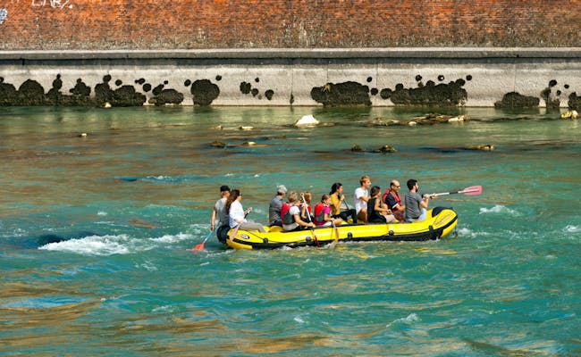 Stein am Rhein
The Ticino is canalized on the last kilometers before its confluence with Lake Maggiore and flows particularly calmly. The banks are fortified and reed belts line the river towards the lake. Here the current also decreases. After disembarking, you can enjoy a sundowner at the beach bar.
The tours are either between Cresciano and Bellinzona or Bellinzona and Magadino and last 1.5 and 2.5 hours for 10 and 16 kilometers respectively. The river Ticino is also called Ticino. The Ticino mountains tower over you during the Böötle.
The water level at Bellinzona is 15-100 m3/s, which is ideal for an inflatable boat trip.
From Cresciano, the Ticino, which is still wild at the beginning, leads past gravel banks and wooded slopes that invite you to barbecue. Navigation is not recommended when the water level is low.
In Cresciano, below the sports ground, a path leads to the shore at the one-boat place. You can get there from Bellinzona via Castione to the stop Cresciaone, Paese. Then continue on foot.
You can reach the entrance Bellinzona by walking to the bridge at the bus stop "Bellinzona, Via Lepori". From there you can get directly to the water.
Shortly after the entrance in Cresciano there are some swales. Between the stones you have to watch out for poisonous vipers, after the Passerella di Claro-Gnosca on the left there is a stone groyne.
On the stretch between Bellinzona and Magadino there are no dangerous places except for some big pieces of rock in the water.
The Bellinzona exit point is not far from a bus stop. It is also possible to get off at Arbedo. In Arbedo the river Moësa flows into the Ticino after the highway bridge, directly after the confluence on the left you can disembark. From the exit you have about 10 minutes on foot to the bus stop Arbedo, Molinazzo.
Magadino is already in the Lago Maggiore. As soon as you cross the Ticino into Lake Maggiore, you will see the white church of Magadino. Below is a small headland where you can disembark. The bus stop "Magadino, Casa Comunale" is a few steps up the main road.
There is no possibility to rent a rubber boat or similar in the vicinity.
The Ticino is not yet widely used for Böötle. Therefore, there is currently only one provider for guided Böötle tours here.
Swiss River Adventures conducts half-day tours of 3.5 hours duration (1.5 hours water).
Highlights:
The tour offer includes a leisurely river tour with some waves on the Ticino. You don't have to expect real white water here. The stable inflatable boats are steered by guides. The meeting point is at the former train station at the base Stazione Osogna Cresciano. The river tour leads you, carried by the current, through the impressive Leventina valley. The trip ends in Arbedo, near the confluence of the Ticino and Moesa rivers.
Extras: return transport to the boarding point in Cresciano, lunch and beverages on the way, extensive aperitif after the boat trip
Included: inflatable boat, complete equipment (incl. paddle, life jacket, in case of bad weather wetsuits), instruction and accompaniment by professional guides, luggage transport to the disembarkation point, happy landing aperitif after the tour.
 Ticino Swissraft (Foto Swissraft Tessiner Tourismusagentur ATT SA)
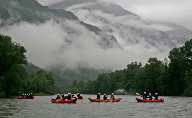 Ticino Swissraft (Foto Swissraft Tessiner Tourismusagentur ATT SA)
The Glatt is only 38.5 kilometers long, but long enough for a pleasant Böötle through nature. The river drains the Greifensee towards the Rhine. Suitable for a ride on the rubber boat is the approximately eight-kilometer stretch between Rümlang and Oberhöri, but there is also an exit halfway down the river in Oberglatt. In total the trip takes about three hours. You can use an interesting article about this with a small map for preparation.
The ride goes along the Zurich airport and thus offers unique views of arriving and departing airplanes of all kinds. Nature reserve and east-west runway of the airport form a good contrast. The river loops from Oberglatt to Niederglatt are particularly beautiful.
In Rümlang you walk from the train station to the Garba bridge, the signs point the way to the Glatt riverside trails. Then you can take the stairs to the right of the Garbabrücke on Klotenerstrasse.
Under the railway bridge at Niederglatt you have to expect an increased current.
In Oberglatt after leaving the airport area, turn right after the wooden Hirschenbrücke. Shortly before, the Himmelbach flows in. after the sludge silos of the sewage treatment plant Fischbach-Glatt comes the last exit. You leave the Glatt on the left side under the road bridge at the bicycle path. Because of several weirs and obstructions with stone blocks, it is not possible to continue from Oberhöri.
There are no rentals of rubber boats near the Glatt yet
There are no suppliers of guided tours here yet.
 Glatt
Glatt Glatt
GlattA rubber boat ride along the renaturalized canal between Weesen and Schmerikon is pure relaxation. The Linth connects the two lakes Walensee and Obersee/Zürichsee, partly via the Linth canal, which is completely free of special danger spots.
Tours between Weesen or Ziegelbrücke and the island of Benken-Giessen (15 km) or from Benken-Giessen to Schmerikon (7.2 km) can be arranged and combined as desired. Grynau (Uznach) is also a suitable entry and exit point. Between Grynau and Schmerikon you have to paddle for about 35 minutes.
There are no critical danger spots.
Linth-Boot or inflatable boat rental Ziegelbrücke is the name of the rental in Niederurnen. It is located directly at the Ziegelbrücke. You can rent a boat from Ziegelbrücke, from Stromschnelle or from Zeltplatz Gäsi and keep it for the whole day.
At the watering place you connect the boat and walk about 5 minutes to the train station in Schmerikon. You can also end your tour on the island of Benken or in Grynau (Uznach) and connect your boat there. In addition to the rental fee, a deposit will be charged. Life jackets, paddles as well as a safety instruction are included.
There are no guided Böötle tours on the Linth yet.
 Zürich
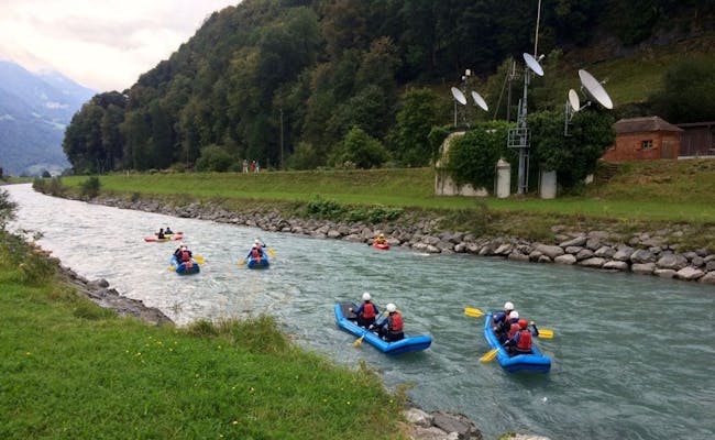 Reuss Linth
You can use the Rhone in Geneva between the bridge Pont Sous-Terre and Le Lignon for a Böötle. Besides beautiful and romantic bridges you have here also the special scenery of huge apartment blocks, which form a special contrast.
The trip goes past the Jonction peninsula, at the tip of which the Arve from the Mont Blanc massif and the Rhône from Lake Geneva flow together. After mighty rock faces on the right, you finally pass the Cité du Lignon.
This is a colossal complex whose main wing, at 980 meters long, is the longest residential building in Switzerland. The Böötle takes about two to three hours on the 5.5 km long route.
Via a concrete ramp you get on at the Bridge Pont Sous-Terre. From Geneva you get here via Geneva train station, take bus line 7 (direction "Vernier, Lignon-Tour") to "Délices". From here you go straight to the bridge Pont Sous-Terre. down
On weekdays, three times a week, a large boat with trash travels on the route; in that case, stay close to the shore.
The exit is on the right at the footbridge, the Passerelle du Lignon. From here you can reach the bus stop "Vernier, Lignon-Cité" via the footpath to the settlement Le Lignon in about 10 min. The bus of line 7 leaves every 15 min to Geneva.
There are no boat rentals nearby.
There are no guided tours offered on the Rhone yet.
 Reuss
Reuss Rhone
RhoneOn the Rheintaler Binnenkanal you sail between Montlingen in Sankt Gallen to Au about 12 km on the shallow canal, without any danger spots. Approximately three to four hours of sailing will let you enjoy the Bregenz Forest Mountains.
You cross a former peat bog, today's Nature Reserve Bannriet. At a staircase on the left bank you have a possibility to moor. There are shady trees and a barbecue area. Up to Au, the current is good enough, so there is hardly any paddling to be done.
If you like, you can extend the Böötle two more kilometers to Sankt Margrethen, or even another six kilometers to the mouth into Lake Constance at Marina Altenrhein. However, these last kilometers are very flat and often blocked with trees. For this, you need flat army inflatable boats, such as those rented from the Steigmatt-Hof in Montlingen.
The Steigmatt-Hof in Montlingen rents out a total of 12 army rubber boats for 4 -5 persons each and 2 army rubber boats for 10 -15 persons each. Life jackets and paddles as well as luggage transport are included. The boats are driven to the boarding point in Montlingen and picked up again in Au.
You have to help with the launching. Bicycles will be transported up to a maximum of 20 pieces upon request. The Böötle can be combined with an overnight stay on the farm.
There are no guided Böötle tours on the Rheintal Binnenkanal.
 Alter Rhein Böötle Rheintal (Foto Seraina Zellweger)
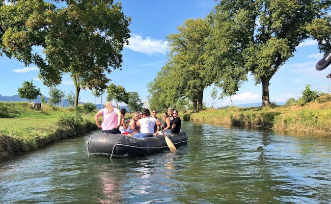 Rheintal Böötle (Foto Seraina Zellweger)
The Thur is considered a torrent and is also suitable in places for a Böötle. The Thur is particularly scenic on its way to the High Rhine. A very beautiful stretch leads from Gütighausen to Andelfingen. You need about three hours for just under ten km. If you still haven't had enough, the ride simply continues. In Flaach is the last exit before the mouth of the Rhine. After that, there is no further exit point because of the Nature Reserve Thurauen before the Mouth of the High Rhine. Swimming is also not allowed here. The next exit is then possible in Rüdlingen after a total of 17 km and 4.5 hours.
The water level can also rise quickly in the last section of the river after major rainfall in the headwaters. The recommended water flow rate is between 10 and 100 m3/s.
There are no boat rentals near the entry points.
There are no guided Böötle tours across the Thur.
 Thur
Thur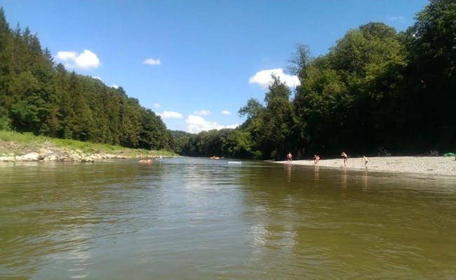 Thur Sonnenhof bei Dätwil
Photos Source: